Canada’s 2023 wildfire season burned 16.5 million hectares of land. This was more than double the previous record and nearly seven times the historical average. The 2024 season continued the trend, with over 5.3 million hectares burned. These fires did not just destroy trees. They displaced wildlife, damaged watersheds, and disrupted ecosystems that will take decades to recover.
After the flames stop, the real work begins. Conservation teams, wildlife managers, and forestry officials must assess what remains. They need to understand which habitats survived, where animals fled, and what recovery actions will work best. This is post-wildfire habitat assessment, and it has become one of the most urgent challenges facing Canadian conservation.
Traditional assessment methods struggle to keep pace. Ground crews cannot safely access burned terrain for weeks or months. Helicopters are expensive and limited in what they can survey. Meanwhile, every day without good data delays recovery planning.
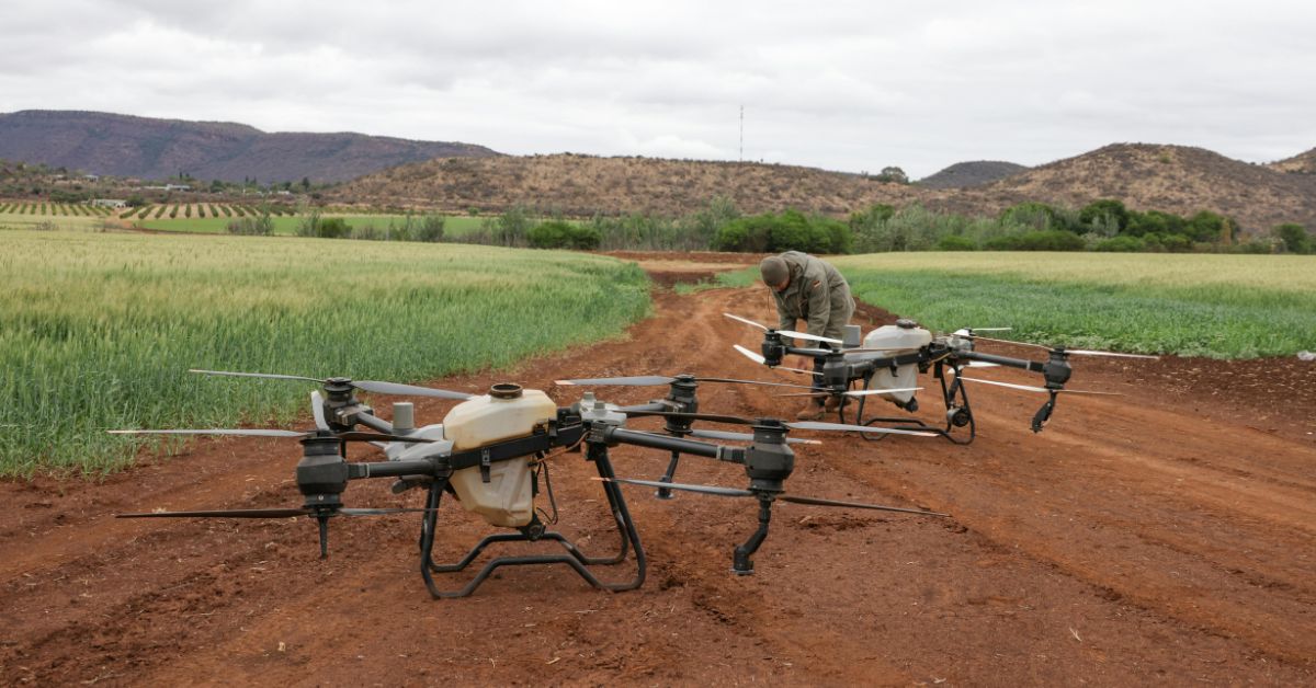
Drone technology is changing this. Conservation drones equipped with thermal cameras, multispectral sensors, and AI-powered analytics can survey burned landscapes within days of containment. They provide the detailed, accurate data that recovery planning requires.
Why Post-Wildfire Assessment Matters for Wildlife
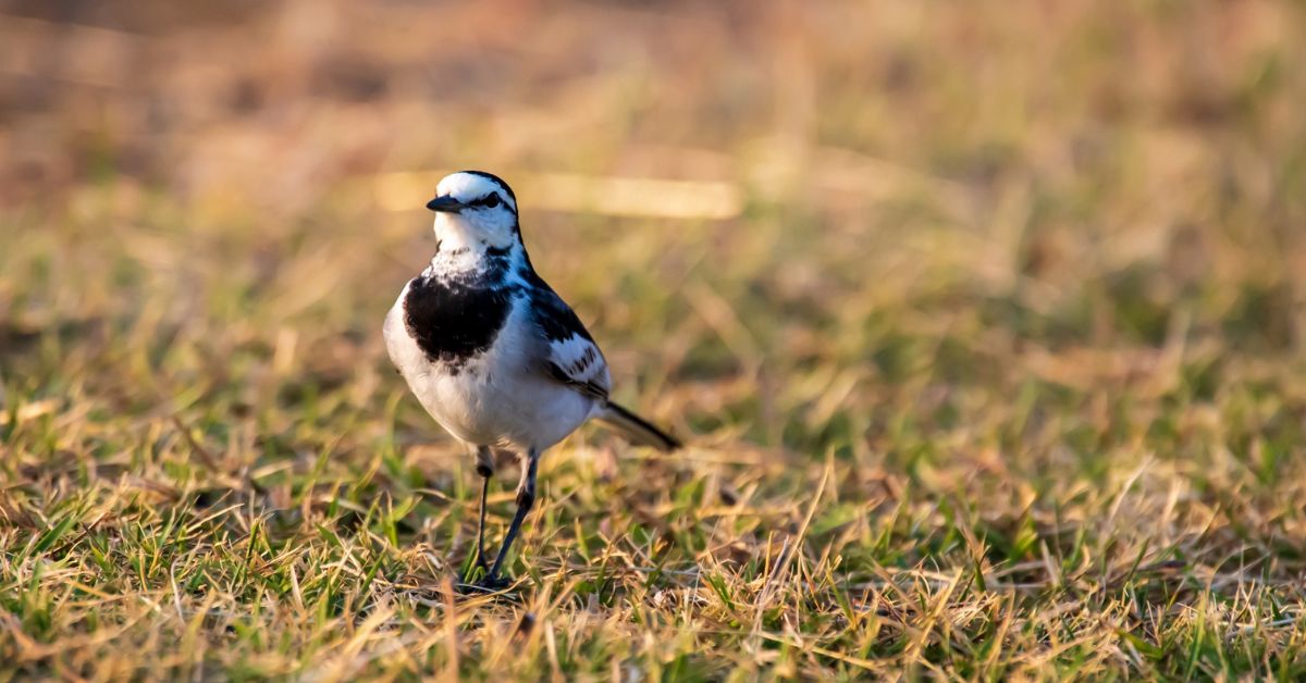
Wildfire does not affect all animals equally. Large mammals can often escape active flames. Birds can fly to safety. But smaller animals, ground-nesting species, and those with limited mobility may not survive. Even animals that escape face a new problem: their habitat no longer exists.
The British Columbia Ministry of Forests notes that wildfire can have both short-term and long-term effects on wildlife populations. During or after a fire, animals may leave their preferred habitats for areas where survival is more difficult. When damage is severe or the land is disturbed repeatedly, some species experience higher than normal mortality rates.
Recovery depends on understanding these impacts quickly. Which areas retained enough vegetation to support wildlife? Where did surviving animals relocate? What corridors remain open for movement between unburned habitat patches?
These questions cannot wait. Wildlife populations stressed by displacement are vulnerable. Predators may concentrate in remaining habitat fragments. Competition for limited food resources increases. Species already at risk face additional pressure.
This is why rapid, accurate habitat assessment is so important. Conservation teams need data to prioritize limited recovery resources. They need to know where to focus reforestation efforts, where to protect remaining wildlife, and where to expect natural recovery without intervention.
Traditional Assessment Methods and Their Limits
Before drones, post-wildfire assessment relied on several methods. Each has significant limitations when applied to burned landscapes.
Ground surveys send trained crews into burned areas on foot. They can collect detailed observations, soil samples, and vegetation measurements. However, ground crews face serious obstacles. Burned terrain is hazardous. Standing dead trees can fall without warning. Ash and debris hide unstable ground. Hot spots can persist for weeks. Many burned areas remain inaccessible until the following spring.
Ground surveys also move slowly. A field crew might assess a few hundred hectares in a week. When fires burn millions of hectares, ground surveys cannot keep pace with the need for data.
Helicopter surveys offer broader coverage. Trained observers can assess burn severity from the air and identify areas where wildlife may have survived. However, helicopter time costs between $1,500 and $3,000 per hour in Canada. Weather and smoke can ground flights for days. And helicopters disturb wildlife, which makes counting survivors difficult.
Satellite imagery provides a wide view but lacks detail. Current satellite resolution cannot distinguish individual animals or assess fine-scale habitat features. Cloud cover and smoke often obscure burned areas during critical assessment periods. And satellite data requires significant processing time before it reaches field teams.
None of these methods meets the current need. Canada needs assessment tools that are fast, safe, detailed, and cost-effective. Drones provide all four.
How Drones Transform Wildfire Habitat Recovery
Conservation drones offer capabilities that traditional methods cannot match. They combine the broad coverage of aerial surveys with the detail of ground observations, at a fraction of the cost and risk.
Rapid Deployment After Containment
Drones can begin surveys within days of fire containment. While ground crews wait for hazardous conditions to subside, drones fly safely overhead. They capture imagery that shows burn severity, remaining vegetation, and landscape features that will affect recovery.
This speed matters. The first weeks after a fire are critical for understanding where animals survived and where they went. Data collected early informs immediate decisions about protecting remaining habitat and planning restoration.
Thermal Imaging for Wildlife Detection
Thermal cameras detect heat signatures from animal bodies. This capability proves valuable in post-fire environments for several reasons.
Burned landscapes offer little visual cover. Surviving animals stand out against blackened terrain during the day. At night, thermal imaging reveals nocturnal species that would otherwise go undetected.
Thermal drones can also identify areas where animals have relocated. Heat signatures concentrated in unburned patches indicate refuge areas that deserve protection. Movement patterns between these patches reveal corridors that wildlife depend on.
Research published in Methods in Ecology and Evolution confirms that drones equipped with thermal cameras can generate wildlife density estimates that outperform ground observations. Drones achieve better results for survey efficiency, area covered, and detection accuracy.
Multispectral Analysis of Vegetation Recovery
Multispectral sensors capture light beyond what human eyes can see. This includes near-infrared wavelengths that reveal plant health and vegetation stress.
In post-fire landscapes, multispectral imaging shows which areas retained living vegetation. It identifies green shoots emerging from burned soil. It distinguishes between vegetation that will recover naturally and areas that need active reforestation.
This information helps conservation teams understand habitat quality. Areas with surviving vegetation can support wildlife sooner than areas of complete burn. Recovery planning should prioritize connecting these surviving patches with restoration efforts in severely burned zones.
High-Resolution Mapping of Burn Severity
Drone cameras capture imagery at centimeter-level resolution. This detail allows accurate mapping of burn severity across entire landscapes.
Burn severity affects recovery timelines. Lightly burned areas may recover in a few seasons. Moderately burned areas may need several years. Severely burned areas may never return to their pre-fire state without significant intervention.
Understanding this variation helps managers allocate resources. Why spend limited funds replanting areas that will recover naturally? Drones help identify where intervention will make the biggest difference.
AI-Powered Data Analysis
Modern conservation drones integrate artificial intelligence for data processing. AI algorithms can automatically identify and count wildlife in thermal images. They can classify vegetation types and burn severity from multispectral data. They can detect changes between survey flights that indicate recovery or decline.
This automation matters when survey data volumes are large. A single drone flight can capture thousands of images. Manual analysis would take weeks. AI processing delivers results in hours.
To understand how these technologies work together, you can explore how Aerowildtech drone systems operate across different terrain types and conditions.
Practical Applications for Canadian Conservation
Canadian conservation faces specific challenges that make drone-based assessment particularly valuable.
Remote Access and Safety
Much of Canada’s burned landscape lies in remote areas far from roads. Ground access may require helicopter transport, adding expense and complexity to traditional surveys.
Drones operate from nearby staging areas. They can survey terrain that would take ground crews days to reach on foot. They eliminate the safety risks of walking through hazardous burned areas.
Large Area Coverage
Canadian wildfires burn at landscape scale. Assessing millions of hectares requires methods that can cover ground efficiently.
Fixed-wing drones can survey hundreds of hectares per flight. Multi-rotor drones capture detailed data over smaller areas where precision matters most. Used together, these platforms provide both the broad coverage and fine detail that recovery planning requires.
Integration with Indigenous Land Management
Many fire-affected areas in Canada overlap with Indigenous territories. Indigenous communities have managed these lands for generations and hold essential knowledge about local ecosystems.
Drone technology can support community-led monitoring programs. Data collected by community members stays with the community. Local knowledge guides interpretation of what the data means for recovery priorities.
This approach respects Indigenous data sovereignty while providing modern tools for traditional land stewardship. Conservation outcomes improve when technology serves community priorities rather than replacing community involvement.
Repeat Surveys for Monitoring Recovery
Recovery from severe wildfire takes years or decades. Single assessments provide a snapshot but cannot track progress over time.
Drones make repeat surveys practical. The same flight paths can be flown monthly, seasonally, or annually to document change. Automated analysis can compare images across time to measure vegetation regrowth, wildlife population trends, and habitat quality improvements.
This longitudinal data helps managers evaluate whether recovery actions are working. It supports adaptive management that adjusts strategies based on observed results rather than assumptions.
Sensor Technology for Post-Fire Assessment
Effective wildfire habitat recovery requires the right sensors for each assessment task. Different technologies reveal different information.
Thermal Cameras
Thermal cameras detect infrared radiation emitted by warm objects. In post-fire environments, they serve multiple purposes.
Wildlife detection works best at dawn or dusk when temperature differences between animal bodies and surroundings are greatest. Night surveys can locate nocturnal species without disturbance.
Thermal imaging also identifies lingering hot spots that could reignite. This safety information protects both wildlife and recovery crews.
RGB Cameras
Standard visual cameras capture high-resolution imagery for mapping and documentation. They show structural details that other sensors miss.
In post-fire assessment, RGB imagery documents burn patterns, remaining vegetation structure, and landscape features that affect wildlife movement. Before-and-after comparisons show the extent of change.
Multispectral Sensors
Multispectral sensors capture specific wavelengths of light that reveal plant health. The Normalized Difference Vegetation Index (NDVI) calculated from this data distinguishes healthy vegetation from stressed or dead plants.
Post-fire applications include mapping surviving vegetation, tracking regrowth over time, and identifying areas where natural recovery is occurring.
Many conservation teams choose systems that combine multiple sensor types in a single platform. This approach maximizes the information gathered during each flight while minimizing the number of surveys required.
For a detailed comparison of sensor options, see thermal vs multispectral vs RGB sensors for wildlife surveys.
The Recovery Planning Process
Data from drone surveys feeds directly into recovery planning decisions. Here is how the process typically works.
First, rapid assessment surveys document initial conditions. These flights capture burn severity, remaining vegetation, and water features across the affected area. The goal is a complete picture of post-fire conditions within days or weeks of containment.
Second, wildlife surveys locate surviving populations. Thermal imaging identifies animals and their refuge areas. Movement patterns emerge from repeated observations. This data shows which species are present and where they concentrate.
Third, analysis identifies priorities. AI tools and human expertise combine to interpret survey data. Which areas can support wildlife immediately? Which areas need restoration before they become functional habitat? Where will natural recovery suffice?
Fourth, planning allocates resources. Limited budgets cannot address everything. Good data helps managers direct funds where they will have the greatest impact. Reforestation, erosion control, wildlife corridors, and protected areas all compete for attention.
Fifth, monitoring tracks progress. Repeat surveys document change over time. Recovery actions can be evaluated and adjusted based on observed results.
This systematic approach replaces guesswork with evidence. Conservation resources deliver better outcomes when guided by accurate, timely data.
Building Capacity for Future Fire Seasons
Climate change is making Canadian wildfires larger and more frequent. The Canadian Climate Institute reports that climate change more than doubled the likelihood of extreme fire weather conditions in Eastern Canada in 2023. Fire season is starting earlier, lasting longer, and becoming harder to contain.
Conservation organizations need to prepare for ongoing wildfire impacts. Building drone-based assessment capacity now will pay dividends for years to come.
Training programs can develop local expertise. Communities and agencies that invest in drone capabilities will respond faster to future fires. Equipment costs have dropped significantly, making adoption practical for organizations of various sizes.
Data infrastructure also requires attention. Survey data must be stored, organized, and accessible for long-term monitoring. Standard protocols ensure that data collected by different teams can be combined and compared.
Partnerships between government agencies, Indigenous communities, academic institutions, and conservation organizations can share costs and expertise. No single organization needs to build all capabilities alone.
Understanding why minimal disturbance matters during wildlife surveys helps teams design monitoring programs that collect data without adding stress to already-challenged populations. Learn more about why low-disturbance monitoring matters for species at risk.
What Comes Next
Canada’s wildfire reality has changed. The scale of burned landscape now exceeds what traditional assessment methods can handle. Wildlife habitat recovery requires better tools and faster data.
Drone technology meets this need. Thermal imaging, multispectral sensors, and AI-powered analysis give conservation teams capabilities that did not exist a decade ago. Costs have dropped. Reliability has improved. The technology is ready for widespread deployment.
The remaining challenges are organizational. Agencies must update regulations to support drone operations. Training programs must expand. Data sharing agreements must facilitate coordination across jurisdictions.
These are solvable problems. The technology exists. The need is clear. Canadian conservation has the opportunity to lead in applying modern tools to wildfire habitat recovery.
Every hectare of habitat that recovers faster means fewer wildlife populations pushed toward collapse. Every survey that identifies surviving animals helps focus protection where it matters most. Every recovery plan built on solid data has better odds of success.
Post-wildfire habitat assessment with drones is not just a technological improvement. It is a fundamental change in how conservation responds to an increasingly fire-shaped landscape. The organizations and communities that adopt these capabilities will be better prepared for the fires that are coming.