It often feels like every other week we hear about another animal or plant on the brink. We’re living through an unprecedented biodiversity crisis. Scientists estimate that around one million species of animals and plants are now at risk of extinction worldwide. Wildlife populations have plunged globally monitored vertebrate wildlife numbers have declined by over 70% on average since 1970. In North America alone, habitats have emptied: about 3 billion birds have vanished from the skies since 1970. These aren’t just abstract numbers; they represent real creatures blinking out or dwindling away.
In Canada, the trend hits close to home. A recent national report painted the starkest picture yet of wildlife loss. More than half of Canadian vertebrate species monitored are in decline, and overall wildlife populations have shrunk by 10% on average since 1970. In the country’s vast forests, mammal populations dropped 42% over the last five decades. Iconic animals from certain bats to caribou herds are struggling. To make matters worse, climate change is reshaping northern landscapes faster than many species can adapt. All of this means we have a rapidly shifting natural world, and keeping track of what’s happening is a massive challenge.
Struggling to Keep Count of Vanishing Wildlife
Why can’t scientists just count and monitor all these species before they’re gone? The truth is, it’s an almost overwhelming task. Earth is incredibly rich in life, much of it in hard-to-reach places. New species are still being discovered, yet many go extinct before we even realize they existed. Experts have estimated there may be around 8–9 million species in total on the planet, but at the current pace of discovery it would take hundreds of years to catalog them all and by then, upwards of 75% could be gone. It’s a race against time that we’re not winning right now.
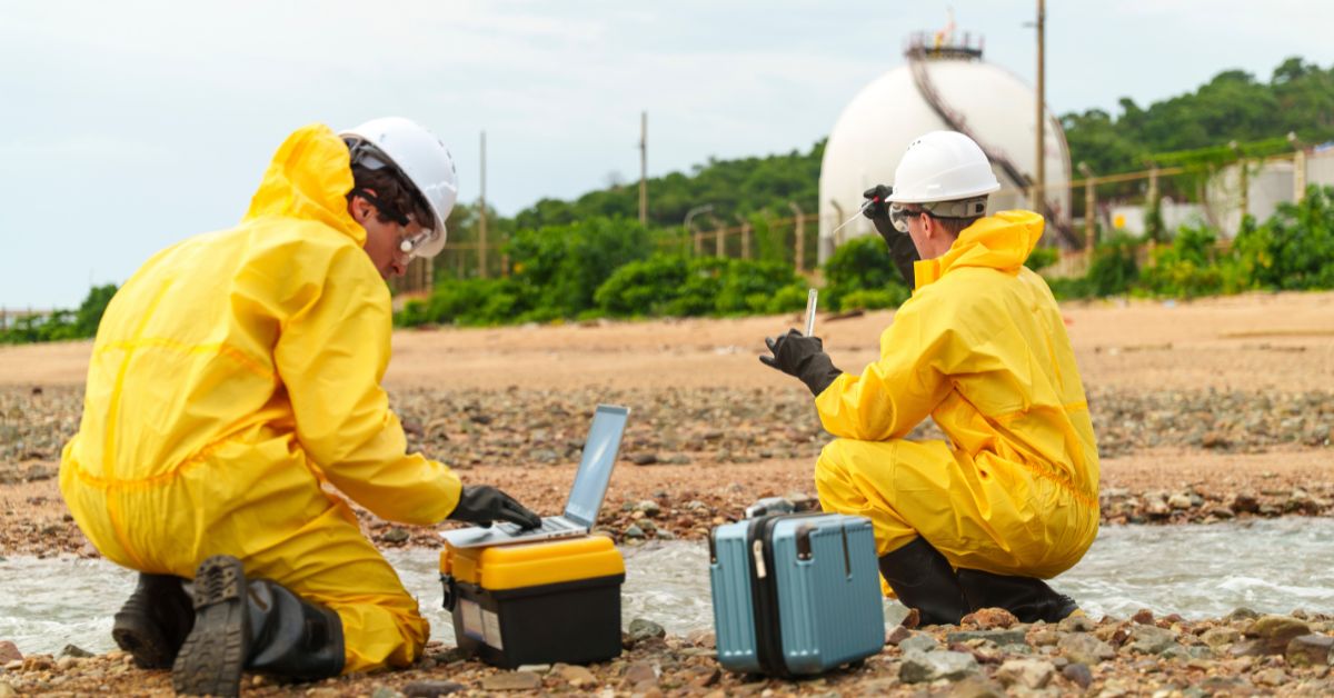
Traditional wildlife tracking methods haven’t been able to keep up. Think about how we’ve typically monitored animals: sending teams into the field on foot, setting manual traps or cameras, even flying in helicopters to count herds from above. These approaches cover only so much ground. They’re slow, labor-intensive, and expensive. For example, conducting a wildlife survey by helicopter can cost thousands of dollars per day budgets get stretched thin fast. And on top of cost, the old-school methods can be invasive. Tranquilizing and tagging animals or tromping through sensitive habitats often stresses the very creatures we’re trying to save, sometimes even harming them. Human observers can only be in one place at a time, and we miss a lot. Nocturnal and elusive species slip by unnoticed. Small, camouflaged creatures hide under our radar. We end up with big blind spots in our data.
All these factors mean species can dwindle or disappear in silence. By the time a decline is detected if anyone was studying that species at all it might be too late to intervene. It’s a sobering thought: we’re losing species faster than our traditional methods can find or follow them. So, where do we go from here? This is where conservationists are increasingly turning to technology for help. In the face of a biodiversity crisis, can new tools give us a fighting chance to catch up?
Drones: New Eyes in the Sky (and Water)
Aerial view of zebras traversing a floodplain. Drones and aerial surveys offer a broad vantage to monitor wildlife in their habitats.
One technology making a real difference is the rise of drones essentially flying (or even swimming and rolling) robots equipped with cameras and sensors. Deploying drones for wildlife monitoring has rapidly gone from a novelty to a game-changer in the field. Unlike a loud helicopter or a trudging field team, a drone can slip overhead almost unnoticed, capturing high-resolution videos and thermal images of animals below. They extend our eyes into remote or dangerous areas without putting observers or animals at risk.
In Canada’s expansive backcountry, drones are proving especially handy. British Columbia, for instance, has begun using drones to monitor endangered mountain caribou in remote alpine regions. Instead of guessing where these shy animals are or trekking for days, researchers can send up a drone to quietly scout vast swaths of habitat. The drone’s cameras can spot the white and brown figures of caribou against the snow or forest, track their movements, and even assess habitat conditions like tree cover or signs of disturbance. All this data helps identify where the herds are hanging on and what threats they face (like wolves or habitat fragmentation), guiding more targeted conservation efforts.
It’s not just about flying, either. One Canadian tech startup, Aerowild Tech, is designing a “multi environment” drone system that can operate across air, water, and land to survey wildlife. The idea is to have an adaptable fleet that could, say, fly over a forest, swim through a wetland, or trundle along a field all the while collecting data without disturbing creatures. These drones carry an array of sensors: high-definition and thermal cameras, night-vision for after-dark, even environmental sensors for things like water quality or temperature. Crucially, they’re paired with onboard or cloud-based AI software that can automatically recognize species in images, count individuals, and flag noteworthy changes in real time. It’s a dramatic upgrade from sending interns to squint through binoculars.
The results are encouraging. Studies and field trials have found that drone-based surveys can be far more accurate and efficient than traditional methods. In fact, population counts from drones have come in anywhere from 43% to 96% more accurate compared to manual headcounts in some cases. Imagine flying a drone over a seal colony or deer herd and getting a precise count in minutes, versus the old way of relying on partial ground observations. Drones also save time and money one analysis in Canada showed using drones could cut monitoring costs roughly in half while covering more ground. When budgets for conservation are limited, that efficiency means more areas and species can be surveyed regularly. And by being less intrusive (modern drones are surprisingly quiet and small), wildlife stays calmer. A caribou might not even look up from grazing as a drone passes overhead, whereas a helicopter would send it running.
We’re even seeing drones unlock new scientific discoveries. In the Arctic, biologists have flown drones to observe narwhals and bowhead whales from above, capturing behaviors that were never documented before. The drones filmed narwhals using their tusks to stun fish – something people had only speculated about until video evidence confirmed it. Similarly, drone footage caught huge bowhead whales rubbing against rocks in shallow water, seemingly to exfoliate or remove dead skin essentially whales having a spa day. These are fascinating insights into animal life made possible by a humble quadcopter quietly hovering where no researcher could safely swim or sail. Beyond the novelty, such behavioral data helps us understand what animals need from their habitats (like shallow rub sites for whales) so we can protect those features.
Of course, drones aren’t a silver bullet. There are still limitations battery life, the skill needed to pilot them in tough weather, and rules about where they can fly. And drones generate lots of footage; someone or something has to sort through all those hours of video. This is where the next piece of the tech puzzle comes in: artificial intelligence to help make sense of the deluge of data.
AI and Big Data: Watching Wildlife 24/7
Modern conservation is increasingly a high-tech data challenge. We have millions of trail camera photos, endless hours of drone and satellite imagery, recordings of jungle sounds, GPS tracks from tagged animals far more than any team of humans could ever review manually. Artificial intelligence (AI), especially advanced machine learning algorithms, are stepping up to shoulder this load. It’s a bit like having tireless digital research assistants that never sleep.
One area AI shines is in processing camera trap images and videos. Camera traps (motion-activated cameras strapped to trees) are used all over the world to capture snapshots of wildlife passing by. They’re great, but they create a firehose of pictures many just empty frames triggered by a waving branch, others with an animal that needs identifying. In the past, interns or volunteers might spend weeks sorting and labeling these. Now, trained AI models can do it in a fraction of the time. For example, a platform called Conservation AI uses machine learning to scan images from camera traps and drones and automatically identify which species are present. The system has already processed over 12 million photos, detecting more than 4 million animals including endangered ones like pangolins, gorillas, and orangutans. Impressively, the AI can churn through tens of thousands of images per hour, whereas a human might manage only a few hundred in that time. This speed can make a life or death difference. In one instance, the AI flagged a poacher trying to snare a pangolin on a reserve, alerting rangers in time to intervene. It’s like having a security camera network for wildlife, with AI guards on duty.
AI is also learning to listen to nature. In dense rainforests or vast oceans, seeing animals is hard, but hearing them is often easier. Researchers are now placing audio recorders in wild areas to capture the chorus of calls birds chirping, frogs croaking, insects buzzing, monkeys howling. These soundscapes contain a wealth of information if we can decipher them. That’s a perfect job for machine learning. In one study, scientists trained a convolutional neural network (a kind of AI) to identify different bird and amphibian species from their calls in an Ecuadorian forest. The AI “listened” to recordings from dozens of sites and could pick out many of the same species that human experts did, just by sound. It’s not flawless yet the model only knew the calls of some species beforehand but it proved that AI can help quantify biodiversity just by eavesdropping on a forest. This approach is incredibly useful for places where visually surveying animals isn’t practical. You could leave a few cheap audio devices out for weeks, then have AI quickly tell you which animals are present from the recordings. It’s like a wildlife census via sound.
Another breakthrough is using AI to predict and model changes. It can take historical data from old field notes to museum records and environmental data like climate or land-use changes and find patterns that humans might miss. For instance, scientists used an AI model to analyze a century’s worth of ecological data preserved in lake sediments (things like DNA fragments and pollen trapped in layers of mud). The AI helped reveal which factors (such as spikes in pesticides or extreme weather years) correlated most with declines in freshwater biodiversity over that time. By learning from the past, the AI could then forecast which combinations of stressors might hit ecosystems hardest in the future. This kind of insight is critical for planning conservation actions it tells us, for example, if curbing certain pollutants might give a lake’s species a better chance to rebound.
Perhaps the most visible power of AI is how it enables citizen science on a huge scale. Millions of everyday people now help document nature using apps like iNaturalist and eBird. If you snap a photo of a weird mushroom or a pretty bird and upload it, AI vision models can suggest what species it might be, helping even non-experts participate. The result is an explosion of data: iNaturalist users have contributed over 200 million observations of creatures around the globe. That’s far beyond what professional scientists alone could gather. Researchers are harnessing this crowd-sourced data with AI to create incredibly detailed maps of where species live. A team at UC Berkeley recently combined iNaturalist photos with satellite images and used deep learning to map the distribution of over 2,000 plant species in California down to a few meters resolution. The AI found correlations between what people observed on the ground and the mosaic of colors and textures in high res satellite pics. In the end, it could predict where certain rare flowers or trees were likely growing, even in areas where human surveys hadn’t been done – with almost 90% accuracy. That’s a stunning leap in our ability to fill in the blanks on species locations. As one researcher put it, with so many people carrying smartphones and sharing what they see, we might soon have something like Google Maps for biodiversity, showing where species are in real time. This kind of knowledge would be gold for conservation, letting us pinpoint hotspots to protect and notice declines as they’re happening.
None of these tech tools replace human expertise they augment it. AI can make mistakes (misidentifying a speck on the lens as a “new” bird, for example), so scientists still vet the results. But by handling the drudgery of data crunching, AI frees up human experts to focus on big-picture strategy and on the ground action. It’s a promising synergy of human and machine intelligence directed at a common goal: understanding and saving Earth’s biodiversity.
Finding Hidden Species with DNA and Sound
Some of the creatures in most trouble are those that are hardest to find. Think of a tiny frog last seen decades ago, or a burrowing mammal that rarely comes above ground. Traditional surveys often overlook these needles in the haystack. But new technology is giving us uncanny abilities to detect life signs that aren’t visible to the naked eye. Two revolutionary methods stand out: environmental DNA and advanced acoustic sensors.
Every animal, as it moves through its environment, leaves behind little traces of itself – bits of hair or skin, droppings, scales, even cells sloughed off in water or soil. This genetic breadcrumb trail is called environmental DNA (eDNA). Until recently, we didn’t have the tools to sift those genetic bits from a creek or a handful of dirt. Now, however, scientists can take a sample of water from a pond, extract the DNA from it, and using genetic sequencing techniques, determine which species have been in or around that water without ever seeing them. It’s pretty amazing like testing the air for invisible clues that a creature was present. eDNA has already led to some exciting rediscoveries. In South Africa, researchers had been searching for De Winton’s golden mole, a small subterranean mammal, which hadn’t been seen in ages and was feared extinct. No one could catch or spot the elusive little mole. But by sampling soil and analyzing the DNA fragments, scientists detected the mole’s genetic signature proof that it was still around in its habitat. Similarly, eDNA helped confirm that certain burrowing seabirds were nesting on a remote island, even though the birds themselves only come out at night and hide in underground burrows. These successes are turning eDNA into a standard conservation tool. If you suspect a rare frog might live in a marsh, you don’t have to find the frog you can just test some water and see if its DNA appears. It’s quicker, less intrusive, and sometimes far more sensitive than eyeballs on the ground.
Acoustic monitoring, as touched on earlier, is another powerful way to find the “hidden” biodiversity. Take frogs and bats many are active at night and can be nearly impossible to spot in dark swamps or sky. But frogs croak and bats emit telltale chirps for echolocation. By installing automated audio recorders, we can capture these sounds and later have software (often AI-driven) analyze them. In places like tropical rainforests where a dozen frog species might be singing at once, computerized analysis can pick apart the frequencies and patterns to tell which species are present based on their unique calls. This has been used to monitor amphibian populations in remote areas to check if any known endangered species are still calling. Silence where there should be a chorus can be a warning sign that a species has vanished from that spot.
Between eDNA and passive audio recorders, conservationists now have a kind of superpower: the ability to survey for life in a habitat without needing to directly observe the animal. It feels a bit like CSI for wildlife testing the environment itself for clues. These methods are especially useful for “lost” species creatures that haven’t been seen in years, but there’s hope they survive unnoticed. A recent study highlighted that we’ve documented over 800 vertebrate species as “lost” to science (not observed in at least a decade), and unfortunately that list is growing faster than the list of species being rediscovered. Using new tech like eDNA, camera traps, and acoustic sensors, search teams have started to turn up some of these long-missing animals. But it’s a daunting race. Often when they are finally found, their numbers are perilously low and fragmented. The tech helps us locate them – the first step and then the real work of protecting and rebuilding populations has to kick in immediately.
A pair of longnose harlequin frogs, once thought extinct, rediscovered in Ecuador. New monitoring techniques helped confirm this “lost” species still persists.
The longnose harlequin frog in the image above is a great example. This brightly colored frog from Ecuador was presumed extinct for decades habitat loss and fungal disease had decimated many tropical amphibians. Amazingly, a few were found again in a protected forest reserve, essentially hiding in plain sight. It took persistent surveys and local knowledge to bring it to light. Now, with tools like eDNA and automated cameras, scientists can keep tabs on such tiny populations more reliably than before, ensuring these “second chance” species aren’t lost again. Importantly, local communities often play a key role in these discoveries. Technology works best when paired with the eyes, ears, and knowledge of people who know the area intimately. In many cases, it was villagers or Indigenous trackers who first pointed researchers in the right direction – for instance, mentioning they’d heard a strange frog call or seen an odd animal years back. By combining community insights with new tech, the odds of finding a rare species shoot up.
A Satellite View of Life on Earth
While drones and ground sensors deal with the fine details, satellites take a step back and give us the big picture. High above us, satellites are continuously snapping images of the planet and collecting environmental data. Traditionally, satellites were used to monitor things like deforestation, climate, and geology. But now they’re increasingly tuned into biodiversity as well – essentially doing wildlife tracking from space.
Satellites have already helped reveal broad trends. For example, by analyzing decades of satellite imagery, scientists confirmed that climate change is outpacing many species’ ability to adapt, especially in polar and mountain ecosystems where warming is extreme. Satellite data showed the dramatic loss of Arctic sea ice, correlating with stress on polar bear populations. In North America, satellite-based studies picked up changes in vegetation and wildfires that align with declines in birds and other animals that depend on those habitats.
The real leap forward is coming with new satellite technologies like hyperspectral imaging. Traditional satellite cameras mainly see similar to our eyes (visible light) plus maybe infrared. Hyperspectral sensors, on the other hand, capture hundreds of bands of light, far beyond human vision. This means from space you can actually distinguish different plant species or habitat types by their spectral “fingerprint.” As one NASA scientist explained, instead of just seeing a solid green forest, the satellite data can tell if that green blob is oaks, pines, or mangroves, because each reflects light in a unique way. This is a big deal for biodiversity tracking. It means we can map ecosystems and how they’re changing (say, one type of forest replacing another, or invasive species spreading) over huge areas without setting foot on the ground. NASA’s upcoming Earth System Observatory missions plan to use such advanced sensors to monitor the health of forests, wetlands, and even microscopic life in the oceans from orbit. For instance, a satellite called PACE will soon be monitoring phytoplankton the tiny algae at the base of the marine food chain – seeing how climate shifts alter their distribution. Changes at the phytoplankton level can signal trouble for fish, whales, and the overall ocean biodiversity, so catching those changes early is vital.
Satellites also shine at covering remote and vast regions that are hard for field biologists to regularly survey. Canada has plenty of those from the high Arctic archipelago to sprawling boreal forests. Using satellite feeds, we can keep an eye on these places in near-real time. If a huge area of forest suddenly browns (perhaps from pest outbreak or drought) or if a new road cuts into wilderness, conservation authorities can be alerted quickly and investigate on the ground if needed. In one collaborative project, NASA and partners used satellite tracking combined with on-ground GPS collars to understand wildlife migration corridors from the Yukon down to Yellowstone. The satellite eyes saw how snowmelt timing and vegetation greening (from images) affected where animals like caribou and elk moved seasonally. Insights like that help planners create protected corridor areas so these animals can roam safely across borders.
Even more futuristic, there’s talk of trying to detect large animals directly via satellite images. It sounds crazy, but with the highest-resolution commercial satellites, analysts have identified elephants from space (you can literally see the gray dots moving on savannah). As satellite resolution improves, perhaps one day we could count herds of certain big species on open plains without a plane or drone at all. For now, the combination of satellite for habitat change and ground/aerial for the animals themselves is a potent mix.
The takeaway is that from space down to the soil, we’ve never had more tools to monitor Earth’s living creatures. This multi layered approach satellites mapping ecosystems, drones patrolling key areas, camera traps and audio recorders catching what slips by, and AI stitching it all together is giving conservationists something closer to a real-time wildlife dashboard. It’s not complete yet, but it’s light years ahead of where we were just a couple of decades ago.
People and Tech Working Together
With all this fancy technology, it’s important to remember that people are still at the heart of conservation. Gadgets and software by themselves won’t save species it’s how we use them that matters. In fact, the most successful efforts so far blend human wisdom with tech power.
For one, local and Indigenous communities are indispensable allies. They often know the rhythms of the land and its animals in ways scientists do not. Technology is now amplifying their voices. For example, Indigenous rangers in Africa and Asia are using drones to patrol for poachers and to track wildlife movements, augmenting their traditional monitoring techniques. In Canada’s North, Inuit observers share knowledge about where and when they last saw certain animals, guiding researchers to deploy tech in the right spots. The WWF’s narwhal drone project mentioned earlier worked so well because it integrated Inuit knowledge (where narwhals feed, how they react to boats) with the drone’s capabilities. The result was not just cool footage, but data that can help set better management rules (like boat speed limits in feeding areas or protected zones). Community members have also been trained to use tools like smartphone apps for reporting sightings. A fisher who snaps a photo of an unusual fish or a farmer who records an odd bird call can provide early warning of species moving into new areas or of one that’s gone missing.
Citizen science, as noted, has been a revolution. In Canada, platforms like iNaturalist and eBird are hugely popular. During events like the City Nature Challenge or the Great Backyard Bird Count, thousands of Canadians log the wildlife they see in springtime, contributing to datasets scientists pore over for trends. This not only yields data but also builds public enthusiasm and awareness. People feel a connection to the species they help document, which can translate into support for conservation initiatives. Technology made this possible by providing easy apps and instant feedback (AI helps identify their sightings, which keeps people engaged).
On the scientific side, collaboration is key. Data needs to be shared widely and quickly. There’s a growing movement to create open databases for biodiversity kind of like how weather data is shared so that everyone from government agencies to volunteer naturalists can access the latest info on species distributions, population trends, and threats. Tech projects often bring together ecologists, software engineers, and even big tech companies. Google and Microsoft, for instance, have lent support through cloud computing grants for conservation AI projects, because analyzing millions of photos or training complex models can require serious computing horsepower.
It’s also worth acknowledging the limitations and risks. Tech can give us false confidence. Just because we have AI monitoring doesn’t mean a species is safe someone still needs to enact protections or reduce the underlying causes of decline (like habitat loss or climate change). There’s a balance to strike. And sometimes tech can have downsides: drones or constant monitoring could disturb wildlife if not used carefully, or AI might overlook things without human oversight. Moreover, not all regions or organizations can afford the latest tech, so we have to be mindful that flashy solutions don’t divert resources from basic conservation work on the ground. Middle ground approaches that combine new tools with old-school field biology often work best. For example, using drones to survey an area and then sending ranger teams to follow up on the ground where the drone spotted something of concern.
At the end of the day, technology is a means, not the end. The goal remains the same as it has always been: to ensure wild species and wild places persist for future generations. The exciting thing is that we now have a better toolkit to help make that happen.
A Cautious Hope for the Future
So, can tech catch up in this race against extinction? The honest answer: it’s trying, and in some cases, yes, it’s closing the gap. In other cases, we’re still lagging behind the rapid pace of biodiversity loss. But the examples we’ve discussed show there is cause for hope – if we act swiftly and smartly. We’re seeing endangered animals monitored in real time, “lost” species found again, and vast ecosystems tracked like never before. Problems that once seemed insurmountable (like surveying an entire rainforest) are now becoming feasible with drones, networks of sensors, and global data crunching.
Importantly, technology is helping us move from being reactive to proactive. Instead of finding out about a population crash after the fact, we might get an early warning from an AI algorithm that notices, say, a sharp drop in elephant sightings on camera traps or an abnormal silence in what should be a frog-filled pond. That gives conservationists a chance to investigate and intervene more quickly perhaps tightening anti-poaching patrols or relocating animals at risk potentially preventing extinctions rather than just documenting them.
However, a gentle reality check: tech alone can’t save biodiversity. If habitats keep getting destroyed at the current rate, if carbon emissions keep warming the climate, many species will still be in trouble no matter how fancy our trackers are. Think of technology as a spotlight and an alarm system. It helps us see the problem clearer and sound the alarm louder, but it doesn’t by itself fix the underlying issues. That part still relies on human decisions, policies, and collective will to protect nature.
The encouraging news is that with better tracking, there’s more accountability and awareness. Governments and communities can’t ignore declines that are clearly documented and mapped. When you can show a map that a species has disappeared from half its range in the last decade, it’s a powerful motivator for action. And success stories – like species brought back from the brink often involve heavy use of tech to monitor progress. For example, when conservationists managed to increase tiger numbers in certain reserves, they proved it with hundreds of camera trap photos and robust data, which also helped them adapt their strategies along the way.
In the coming years, we can expect conservation tech to become even more accessible and widespread. Cheaper drones, more open-source AI tools, and global initiatives to share satellite data mean even small organizations or developing countries can harness these methods. We might see automated alert systems where if a critically endangered animal is detected somewhere by any sensor, a network instantly notifies local conservation teams. It’s a bit like a guardian system for wildlife.
In a way, humanity is finally equipping itself with the tools needed to be responsible stewards of the planet’s other inhabitants. We’ve always had the compassion and concern (at least among many) now we’re adding the technical capabilities to match. It won’t be perfect, and it won’t solve everything, but it can tilt the balance in favor of conservation.
Looking forward, one can imagine telling future generations: We nearly lost so much, but we turned it around. We used every tool we could from tiny DNA tests in a stream to eyes in the sky to make sure we knew what was happening to wildlife everywhere, and we used that knowledge to protect them. That scenario is still within reach if we continue to innovate and, crucially, if we choose to value and save the incredible diversity of life that shares our planet. Technology is helping to buy us time and information. What we do with that that part is up to us.