Biodiversity is declining at an alarming rate, faster than at any time in human history. In Canada alone, one in five species is at some level of risk of extinction. Conservationists are racing to protect what remains, but how do we measure if our efforts are making a difference? That’s where MRV for conservation projects comes in. MRV stands for Monitoring, Reporting, and Verification, a systematic process to track conservation outcomes, report on progress, and verify results. In other words, MRV provides the data-driven “proof” that our wildlife and habitat conservation actions are working or signals when we need to change course.
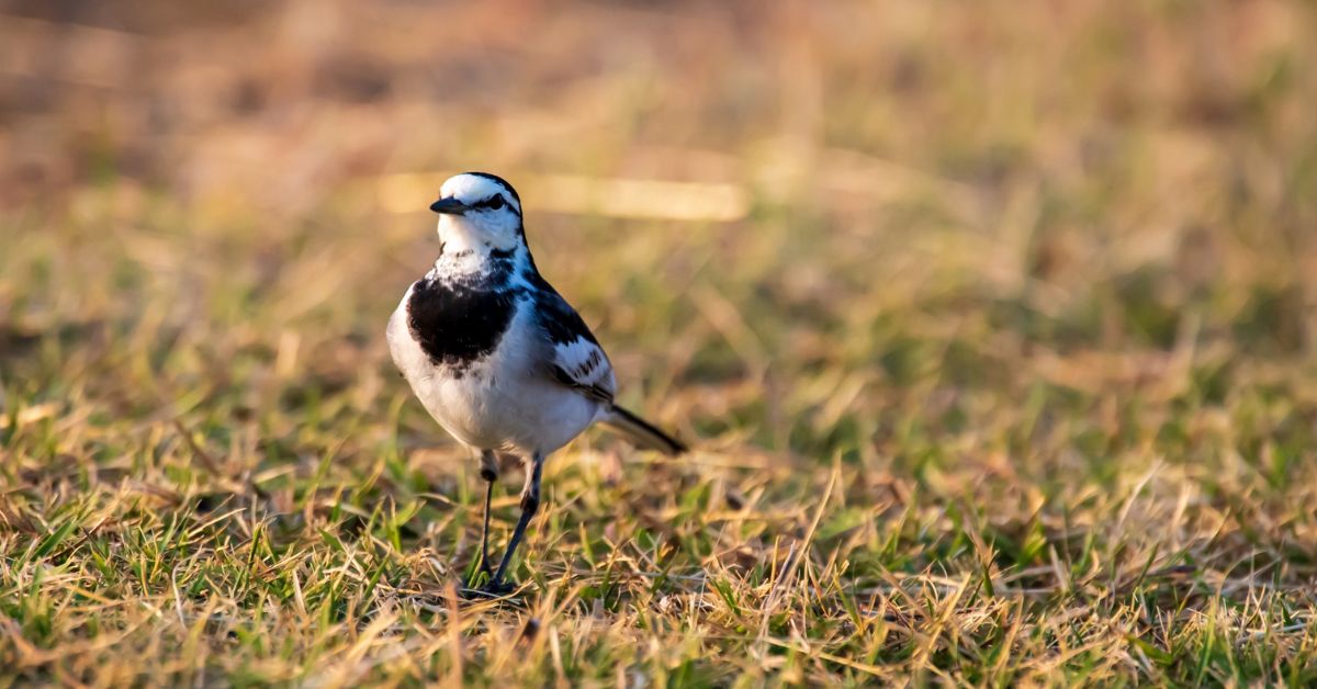
However, a major challenge in conservation is the lack of good data. Canada is home to roughly 80,000 species, yet scientists admit we know next to nothing about thousands of them. Without better monitoring, declines can go unnoticed until it’s too late. (For example, grassland bird populations have plummeted ~60% in Canada since 1970.) New tools like drones, eDNA analysis, and citizen science are now helping uncover these “biodiversity blind spots”. High-tech wildlife surveys using wildlife monitoring drones, acoustic recorders, and advanced sensors give us the missing eyes to see what is happening in time to act. By implementing MRV, conservation teams can detect trends early and prioritize actions before wildlife declines become crises.
In this beginner’s guide, we’ll explain how to implement MRV in conservation, from designing a monitoring plan to leveraging modern tech like drones and AI for habitat reporting. You’ll also learn why MRV is so important for accountability and success, and how Aerowildtech’s innovative drone platform, AI analytics, and partnerships (e.g. with Indigenous Guardians) provide scalable, low-impact MRV solutions for conservation projects.
What is MRV (Monitoring, Reporting, Verification)?
In simple terms, MRV is a framework to make sure conservation projects are measured and credible. It breaks down into three key components:
Monitoring: Systematically observing and recording data on conservation targets. This could mean counting wildlife populations, tracking habitat conditions, or measuring ecological indicators over time. Effective monitoring uses consistent methods (transect surveys, camera traps, drones, satellite images, etc.) to gather reliable data about what’s happening on the ground.
Reporting: Organizing the monitored data into clear, understandable information and sharing it with stakeholders. Reporting can include writing scientific reports, creating maps or dashboards, and communicating progress toward goals. The focus is on transparency, documenting results (good or bad) in a standardized way so funders, communities, and policymakers can see the outcomes. For example, a conservation NGO might produce annual reports on forest cover change or wildlife counts for a protected area.
Verification: Ensuring the reported results are accurate and trustworthy. Verification often involves independent review or cross-checking of the data. It could mean external audits of methods, peer review by scientists, or community validation of findings. Essentially, verification is a quality assurance step. It confirms that the monitoring data and reports are correct and that conservation claims (e.g. “wildlife numbers increased by 20%”) are backed by evidence. Verified data gives credibility to conservation projects.
By integrating monitoring, reporting, and verification, MRV creates a full loop: you measure what’s happening, tell others what you found, and check that it’s true. This process is increasingly seen as essential for effective conservation management. It turns gut feelings and anecdotal observations into solid evidence.
Why MRV is Important for Conservation Projects
Implementing MRV might sound technical, but it has huge benefits for conservation initiatives. Here are a few key reasons why MRV matters:
Tracks Progress Toward Goals: MRV provides concrete data to measure if you’re meeting your conservation targets. It’s like a GPS for your project, showing whether you’re on course to achieve goals such as increasing a species’ population or restoring a certain amount of habitat. For instance, MRV systems can tell us if we’re moving closer to global biodiversity objectives like the Convention on Biological Diversity targets or the 30×30 protected areas goal.
Ensures Accountability and Transparency: Donors, governments, and the public want to know their conservation investments pay off. MRV creates a transparent record of what was promised versus what was achieved. If a government or NGO commits to protect wildlife, MRV data can verify they’re following through. This accountability builds trust. It shows conservation teams are keeping their promises and allows others to independently confirm the results.
Informs Better Decision-Making: Good decisions depend on good information. MRV yields reliable data that helps project managers and policymakers decide where to focus efforts and resources. For example, if monitoring shows a certain bird species is declining in one region but stable in another, conservationists can target interventions (like habitat restoration or anti-poaching patrols) where they’re needed most. MRV essentially turns raw observations into actionable insights.
Attracts Funding and Support: When you can demonstrate clear outcomes with data, it’s easier to rally support. Funders are more likely to back projects that have measurable results, and local communities are more likely to engage when they see evidence of success. MRV documentation (e.g. reports, maps, success metrics) can be shared to celebrate wins or honestly discuss challenges, bringing more people on board to help. In short, showing your impact helps grow your impact.
In summary, MRV acts as the “compass and report card” for conservation projects. It points you in the right direction and grades your progress along the way. Especially in an era of big conservation pledges and tight budgets, MRV is crucial to make sure every effort counts and to course-correct if needed.
And importantly, MRV isn’t just about paperwork. It directly aids wildlife. By catching negative trends early, we can trigger rapid responses (for example, if monitoring reveals a sharp drop in turtle nests, managers can investigate causes and ramp up protections). Ultimately, MRV helps conservation projects be adaptive, credible, and effective in saving nature.
How to Implement MRV in Conservation Projects (Step by Step)
So, how can your organization implement an MRV system for a conservation project? Here’s a step-by-step guide:
1. Define Clear Goals and Indicators
Start by establishing what success looks like and how you’ll measure it. Identify the key conservation targets (e.g. a species population, habitat extent, water quality) and decide on indicators for monitoring them. For example, your goal might be “increase tiger population by 25% in five years,” with indicators like tiger sightings on camera traps or paw-print counts. Make sure your indicators are measurable and relevant to your project’s objectives. This planning stage sets the foundation for MRV. You can’t monitor effectively until you know what you’re measuring and why.
2. Develop a Monitoring Plan (Methods and Tools)
Next, choose how you will gather data on your indicators. Select monitoring methods and tools appropriate for your project’s species and environment. Common approaches include field surveys (walking transects, point counts), camera trap networks, acoustic recorders, satellite imagery, and wildlife monitoring using drones. Often, a mix of methods works best.
Tip: Leverage technology to cover more ground with less effort. For instance, drones equipped with the right sensors can survey large or hard-to-reach areas, complementing on-the-ground observations. (For guidance on sensor choices for drone wildlife surveys, see Aerowildtech’s post on thermal vs. multispectral vs. RGB sensors for wildlife surveys.)
Also consider engaging local communities or rangers in data collection. Indigenous Guardians and citizen scientists can be invaluable allies in monitoring, providing on-the-ground knowledge and extending your project’s reach. Document your monitoring protocols clearly (frequency of surveys, sampling locations, equipment used) so the data will be consistent and repeatable.
3. Collect Data and Manage It Securely
With a plan in place, carry out your monitoring activities regularly. Stick to the schedule and methods decided above to maintain data quality. As you collect raw data (whether it’s wildlife counts, photos, audio recordings, etc.), establish a system to store and organize it safely, for example, a cloud database or spreadsheet where field teams can input their observations.
It’s crucial to also manage data quality at this stage: train your team so they record data accurately (using standard forms or apps), and perform spot-checks or audits on the data entries. Utilizing software and AI for habitat reporting can greatly speed up this phase. For instance, machine learning algorithms might automatically count animals in drone images or flag changes in forest cover from satellite data. Such AI analytics help turn raw data into preliminary findings quickly. Ensure you also log metadata (dates, locations, observers) for context. Good data management now will make analysis and reporting much easier later.
4. Analyze and Report Your Findings
Once you have sufficient monitoring data, analyze it to extract meaningful results. Calculate metrics that matter for your goals, e.g. population trends over time, percentage of habitat loss/gain, number of breeding pairs this season, etc. Use visualization tools to create charts or maps if helpful. Then compile the results into a clear report.
In your MRV report, compare the findings against your baseline or targets: are things improving, staying stable, or getting worse? Be honest and transparent in documenting these outcomes. Include an executive summary for non-technical readers, and use visuals (graphs, GIS maps, photos) to communicate key points. It’s often useful to align your report with any required formats (for instance, government or donor templates).
This report should be shared with all stakeholders: conservation partners, funding agencies, local communities, and possibly the public (via websites or meetings). Transparent reporting not only fulfills accountability; it also educates and engages others in the conservation story.
5. Verification, Evaluation, and Adaptation
The final step is making sure the reported results are valid and then figuring out what they mean for your project’s future. Verification can involve internal data checks, peer review by external experts, or even third-party audits. You might invite a biologist not involved in the project to review your methods and confirm the numbers make sense. Technology can assist here too (for example, cross-verifying drone counts with on-foot counts for a subset of sites).
If community members participated in monitoring, hold workshops to review the findings together and get their input. Local knowledge can often validate (or question) the patterns you’re seeing. Once confidence is built that “yes, these results are accurate,” use them to evaluate progress. Are you on track to meet the goal? If not, why?
MRV is most powerful when it feeds back into management decisions. Perhaps you discover a certain intervention isn’t working as well as hoped. You can then adapt your strategy (adaptive management) and allocate resources to actions that have the most impact. In short, verification and evaluation close the loop, ensuring the MRV process leads to learning and improvement. This way, each cycle of monitoring, reporting, and verification refines your conservation approach for better results.
By following these steps, even small organizations can implement MRV in a structured way. Start small and simple. You can always expand your monitoring program as capacity grows. The key is to embed MRV as a continuous practice, not a one-off task. Over time, a solid MRV system will enable you to demonstrate progress, make informed choices, and ultimately achieve greater conservation impact.
High-Tech Tools Enhancing MRV: Drones, Sensors, and AI
Traditionally, conservation monitoring meant boots on the ground, biologists trekking through forests or snorkeling in reefs to gather data. Today, we have an expanding toolbox of high-tech aids that can supercharge MRV efforts. By using these tools, projects can cover more area, reduce disturbance to wildlife, and analyze data faster than ever. Let’s look at a few game-changers:
Drones (Unmanned Aerial Vehicles)
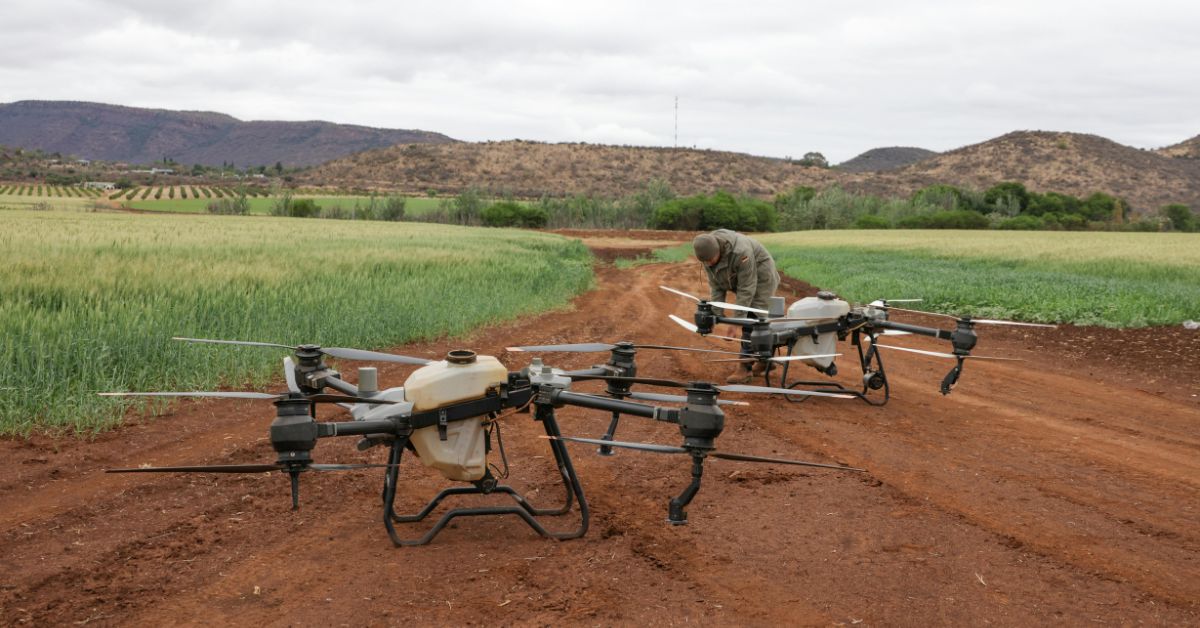
Drones have emerged as a powerful asset for wildlife monitoring and habitat surveys. They offer eyes in the sky that can access remote or rugged areas humans might struggle to reach. In fact, drones often provide a safer, less costly, and more precise way for scientists to observe wildlife compared to traditional methods like manned aircraft. They’ve been used to count seals on inaccessible coastlines, map orangutan nests high in rainforest canopies, and even detect illegal activities like poaching or logging.
Modern conservation drones can carry various cameras and sensors to suit the task: high-resolution RGB cameras for general imaging, thermal infrared sensors to spot warm-bodied animals at night, multispectral cameras to assess vegetation health, etc. Because drones capture geo-tagged photos and videos, the data they gather can be fed into software for analysis. For example, images from a drone survey can be processed with AI algorithms to automatically count animals or identify species, vastly improving the accuracy and speed of population counts. One study noted that drones are “going to change the way data is collected,” as they allow automated, repeatable monitoring from above.
Just as importantly, drones can reduce human disturbance when used thoughtfully. A drone buzzing overhead is generally less intrusive than a team of researchers tramping through a nesting ground. However, drone pilots must take care: research has shown that if flown too close or loudly, drones can stress wildlife (for instance, raising heart rates in bears) even if the animals don’t outwardly flee. Noise is a particular concern. Many drones emit a high-pitched buzz, and indeed some national parks have banned drones due to noise impacts on animals.
The good news is that engineers are now designing drones that don’t scare the animals, using quieter propellers, electric motors, and flight algorithms that keep a respectful distance from wildlife. By choosing the right equipment and operating drones responsibly (e.g. flying at higher altitudes when needed, avoiding nesting seasons), conservationists can reap the benefits of drones without disturbing the very creatures they aim to protect.
Advanced Sensors and IoT Devices
Beyond drones, a range of other remote sensing and Internet of Things (IoT) technologies are boosting MRV capabilities. Camera trap networks, for instance, quietly snap photos of wildlife 24/7 and are getting smarter with AI-based species recognition. Acoustic sensors can record animal calls (like frog chirps or bird songs) across large areas, enabling audio monitoring of species presence. There are even IoT environmental sensors for factors like temperature, water quality, or soil moisture that transmit real-time data via satellite.
These technologies allow continuous monitoring with minimal human presence. Selecting the appropriate sensor is key: thermal cameras excel at spotting nocturnal mammals; acoustic loggers are great for cryptic birds or bats; LiDAR can map forest structure in 3D, and so on. Multi-sensor approaches (combining say, drone imagery with ground sensors) often paint the fullest picture of an ecosystem’s health.
Artificial Intelligence and Data Analytics
As monitoring devices flood us with data, AI has become indispensable for making sense of it all. AI-powered analytics can rapidly process images, audio, and big datasets far faster than any person. For example, machine learning models are used to identify animals in drone footage, detect changes in satellite images (like new deforestation or wetland loss), and even diagnose animal behavior or health from camera footage.
AI is also being applied to habitat reporting, analyzing patterns (like vegetation indexes from multispectral images) to report on habitat quality or predict where species might be in trouble. Using AI for these tasks not only saves time, it can also reveal subtle trends that humans might miss. Moreover, AI enables predictive insights: by training on historical data, algorithms might forecast future population declines or climate impacts on a habitat, giving conservationists a heads-up to take preventive action.
Many of these AI tools are becoming user-friendly, so even small NGOs can utilize them via open-source software or partnerships with tech companies. The result is that MRV programs today can handle much larger volumes of data with accuracy, yielding richer insights into ecosystem changes.
Together, drones, sensors, and AI are transforming MRV into a high-tech endeavor. They allow conservation projects to scale up monitoring to regional or even national levels. For instance, an organization can use a fleet of drones to survey an entire coastline’s bird colonies, or tap into satellite data to monitor every protected area in a country, tasks that would have been unthinkably labor-intensive before.
It’s important to remember technology is a means, not an end; these tools augment, rather than replace, traditional fieldwork and local knowledge. But when tech is combined with on-the-ground expertise, MRV systems become more powerful, efficient, and precise. This combo of innovation and field wisdom is exactly what Aerowildtech is aiming for with its solutions.
Aerowildtech’s Innovative MRV Approach: Drones, AI Analytics, and Community Partnerships
Aerowildtech is a Canadian startup at the forefront of applying advanced technology to wildlife conservation. In fact, our mission is embedded in our name: “aero” (drones) + “wild” (wildlife) + “tech”. We’re building an integrated MRV platform tailored for conservation projects. What makes our approach unique? In a nutshell: multi-environment drones, AI-driven data analysis, low-disturbance design, and partnerships with Indigenous Guardians. Here’s how each element contributes to better MRV outcomes:
Multi-Environment Drone Platform
Aerowildtech has developed a revolutionary drone system that isn’t limited to just the skies. Our platform can operate across air, land, and water, adapting to different field conditions. This means one drone can perform aerial surveys over forests or grasslands, land on a pond or river for aquatic monitoring, and even traverse on the ground for close-ups, all in a single mission.
By covering multiple environments with one modular drone, we eliminate many gaps in monitoring. Conservation projects often span diverse habitats (wetlands, coastlines, woodlands), and traditional drones or equipment might handle only one. Our multi-environment drone can seamlessly transition, providing continuous data across ecosystem boundaries.
This innovation enables more comprehensive MRV. You get synchronized data on, say, bird populations and water quality and vegetation cover, all integrated from one system. It’s also cost-effective: instead of deploying separate teams or devices, a single Aerowildtech drone can do it all. We’re proud that this technology is first-of-its-kind and designed specifically with conservation needs in mind.
AI-Powered Real-Time Analytics
Collecting data is only half the battle. Making sense of it fast is crucial for timely decisions. Aerowildtech’s platform comes with AI analytics pipelines that process drone data in real time. As our drone captures images or sensor readings, machine learning algorithms immediately get to work, detecting wildlife in photos, counting individuals, classifying habitats, and flagging any notable changes or anomalies.
For example, our AI can instantly recognize species from thermal images or identify areas of habitat degradation from multispectral scans. These on-the-fly insights mean that by the time a drone lands, you already have an initial report of findings. This greatly accelerates the MRV cycle. Conservation teams don’t have to wait weeks for manual data entry and analysis. They can get actionable information the same day, allowing for quicker responses (like dispatching rangers to a detected threat).
Our AI models are trained on diverse wildlife datasets and can be customized to focus on target species or indicators of interest. By automating the heavy data crunching, we free up biologists to focus on interpretation and action. The end result: MRV that is not only accurate, but fast and scalable.
Low-Noise, Low-Impact Design
A core principle for Aerowildtech is that technology should never harm the wildlife we’re trying to save. We’ve put extensive R&D into making our drones as quiet and non-intrusive as possible. This includes specialized propeller designs, sound-dampening materials, and flight pattern programming that avoids startling animals.
Our UAVs have low-noise electric motors that are far quieter than hobby drones. In field tests, animals often don’t even notice the drone if it’s at a reasonable altitude. We also design for minimal physical footprint: the drones can take off and land in tight spaces without the need for loud gas generators or heavy infrastructure. All of this means Aerowildtech’s platform can collect data without chasing away the very wildlife being monitored.
This “gentle” approach is not just ethical, it also improves data quality. Calmer animals behave more naturally, leading to more representative observations. (After all, an MRV system isn’t useful if it alters animal behavior.) By designing drones that don’t scare wildlife, we ensure MRV is truly low-impact. Our equipment is also weather-resistant and rugged, capable of operating in Canada’s harsh field conditions, from northern winters to coastal rains, so that monitoring can continue year-round reliably.
Collaboration with Indigenous Guardians and Local Communities
Technology alone cannot solve conservation challenges. People and relationships are equally important. Aerowildtech strongly believes in a collaborative model, working hand-in-hand with Indigenous and local communities who are stewards of the land. We actively partner with Indigenous Guardians programs across Canada, supporting Indigenous-led monitoring and capacity building.
Through these partnerships, we train community members (Guardians) to operate our drone systems and manage data for their territories. This approach ensures that MRV is not a top-down external process, but rather one that empowers those who know the land best. Indigenous Guardians bring generations of traditional knowledge and keen observation skills that complement high-tech data with on-the-ground context.
Moreover, we respect Indigenous data sovereignty. The data collected on their lands is co-owned and shared with communities to support their decision-making and rights. By integrating Guardians into MRV projects, we also create local employment and education opportunities, making conservation more inclusive.
Aerowildtech has seen first-hand that when Indigenous and non-Indigenous experts work together, the resulting MRV insights are richer and more holistic. It’s a true win-win: technology amplifies the reach of community monitoring, and community involvement grounds the technology in cultural understanding and trust. We aim to replicate this model with other local groups as well, such as park rangers, student researchers, and citizen science volunteers who can all be part of the MRV network.
Aerowildtech’s multi-faceted approach, combining cutting-edge drone technology, AI analytics, and community partnerships, is designed to produce MRV solutions that are both effective and sustainable. Our platform is currently being piloted in various conservation projects, from monitoring migratory bird sanctuaries in the Prairies to surveying at-risk caribou habitat in boreal forests.
Early results are promising: we’re able to gather high-resolution data across large areas with minimal disturbance, and deliver insights faster than traditional methods. More importantly, we’re doing so in a way that builds local capacity and respects wildlife.
As Canada and the world push toward ambitious conservation targets like the 30×30 goal (protecting 30% of lands and waters by 2030), innovative MRV methods will be critical. Governments and NGOs need robust data to measure progress toward 30×30 and adjust strategies to meet those targets. That’s exactly what Aerowildtech’s system is built to provide (see our blog on the role of AI in the 30×30 goal for more context on tech’s role in large-scale conservation). By enabling continuous, low-impact monitoring, we give conservation leaders the information they need to make smart policy and management decisions in line with these global objectives.
Conclusion and Call to Action
MRV might sound like a technical process, but at heart it’s about accountability to nature, making sure our conservation promises translate into real-world results. By monitoring, we listen to what ecosystems and wildlife are telling us. By reporting, we share those lessons openly. And by verification, we hold ourselves accountable and earn trust. In an era when biodiversity loss is both a local and global crisis, MRV provides a path to smarter, transparent, and more effective conservation.
The exciting part is that modern technology and collaborative approaches are making MRV easier and more powerful than ever. A project team on a shoestring budget can now deploy a drone or set up a citizen science app to gather data that was once unreachable. AI can crunch numbers in seconds that used to take experts months. Indigenous and community partners are increasingly leading monitoring efforts, blending traditional knowledge with high-tech tools. These trends give us hope that we can scale up conservation monitoring to match the scale of the problems we face.
If you’re an NGO, researcher, or government agency involved in conservation, it’s time to embrace MRV as a core strategy. Not only will it improve your project outcomes, it will also help you demonstrate impact to funders and the public. Aerowildtech is here to help. We specialize in providing scalable, low-impact MRV solutions, from our multi-environment drone platform to AI-driven analytics, tailored for conservation needs. Our team can support you in designing a monitoring program, deploying the technology, and training local partners to sustain it. The result? Better data, better decisions, and better conservation results.
Ready to take your conservation project to the next level with MRV? We encourage you to contact Aerowildtech to explore how our drone and AI solutions can be applied to your specific challenges. Together, we can build an MRV system that not only captures amazing data, but does so safely, ethically, and at scale, allowing your efforts to truly make a difference for wildlife and ecosystems. Let’s turn information into action and ensure that Canada’s (and the planet’s) natural heritage is monitored, protected, and thriving for generations to come.