Canada is known for its vast wilderness and iconic wildlife. But lately there’s a sobering reality: many of Canada’s animal populations are quietly shrinking. A recent WWF report found that overall wildlife populations in Canada have declined about 10% since 1970. That might not sound huge, but remember that’s an average some species (like certain caribou herds or grassland birds) have plummeted much more. In grassland habitats, wildlife populations have dropped by over 60% on average. It’s a crisis that’s largely unfolding out of sight. Animals are disappearing in remote forests, mountains, and Arctic tundra where almost nobody is watching. And if we can’t see what’s happening, how do we even begin to fix it? This is where drones are starting to come into the picture, almost literally as new “eyes in the sky.” They just might be the missing eyes we need to monitor and protect Canada’s fragile wildlife before it’s too late.
Canada’s Wildlife at a Crossroads
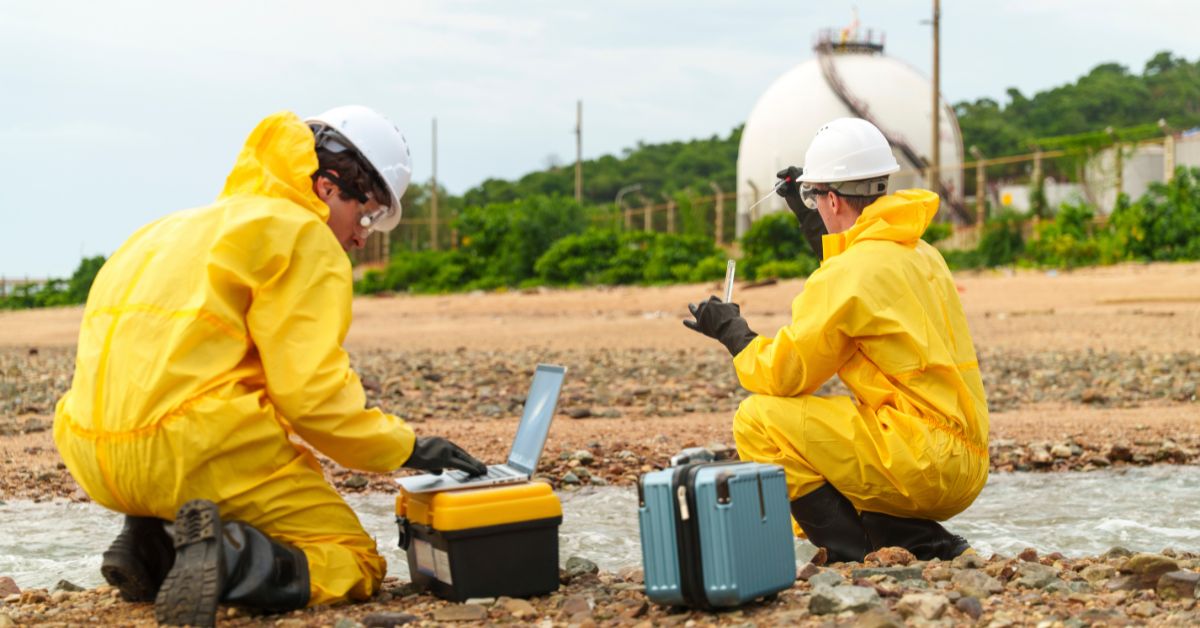
When we talk about a wildlife crisis, it’s not hyperbole. More than half of monitored species in Canada are declining in number. From woodland caribou in the boreal forests to certain whale populations off our coasts, many species are struggling. Human activities, climate change, and habitat loss have all taken a toll. Yet a big part of the problem one we don’t often consider is simply knowing what’s happening out there in the wild in real time. Canada’s wilderness is massive. You can fit countries inside some of our forests and northern territories. Keeping track of wildlife across such huge, rugged spaces is a daunting task. Researchers and wildlife rangers do their best with the tools they have: trail cameras, tracking collars, occasional helicopter surveys, and on-foot fieldwork. But those methods have serious limits. A trail camera only sees a tiny area. A biologist on foot can’t be everywhere (and might hike all day just to find signs of one animal). Even a helicopter team can only cover so much ground and it costs a fortune to keep a chopper in the air for wildlife surveys (often $3,000 to $10,000 per day in Canada). Not to mention, sending people up in small planes or helicopters can be downright dangerous. Tragically, wildlife biologists have died in crashes while radio tracking animals (one crash in 2008 killed a bear researcher in the U.S., and in 2014 a scientist died tracking caribou in Alberta). So, we have this huge country, a lot of animals in trouble, and a limited ability to keep an eye on them. It often feels like trying to solve a puzzle blindfolded.
This lack of real time eyes on the ground (or in the air) means problems can go unnoticed until they’re severe. A polluted river could be killing fish or a new disease could be hitting a herd of bighorn sheep, and we might not find out until the damage is done. Conservation teams do react to known issues, but without up to date information, interventions often come late. In short, there’s a visibility gap in Canadian wildlife conservation. We need a better way to watch over animals spread across mountains, forests, and tundra ideally without disturbing them or blowing the budget. Interestingly, some of the same technologies that once felt like science fiction are now looking like practical solutions to these challenges. Drones, in particular, are emerging as a powerful tool to fill these gaps.
How Drones Offer New Eyes in the Sky
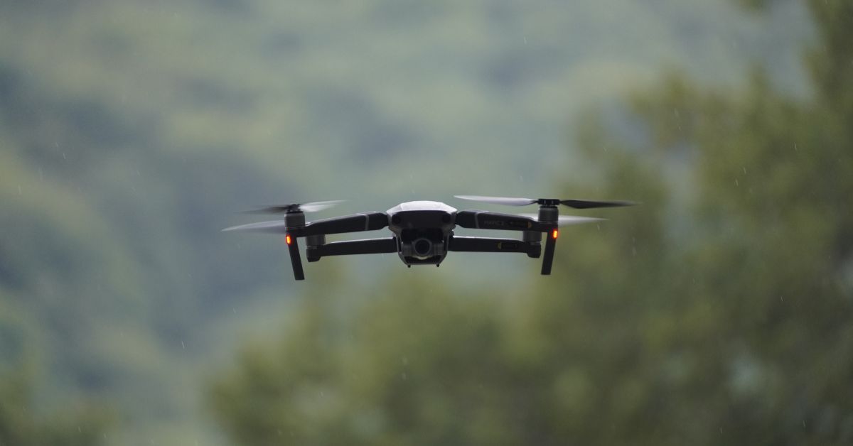
You’ve probably heard of drones being used for fun (like taking cool aerial videos) or in industries like real estate or agriculture. But in recent years, scientists and conservationists have started sending these little unmanned aircraft out into the wild not to spy for secret missions, but to quietly observe wildlife. And the results have been pretty amazing. Drones are essentially flying cameras (and sensors) that we can pilot into hard to reach places. For a country with as much wilderness as Canada, that’s a game changer. Suddenly, we have a way to get a bird’s-eye view of animals without needing a full flight crew or a big budget.
One immediate benefit is safety and cost. If a drone crashes, it’s a lump of plastic and metal on the ground not a human life. Remember those risky low-altitude flights biologists took in the past? Using a drone means “better the drone than the researcher,” as one wildlife drone pilot quipped after an angry Osprey knocked his drone out of the sky. And with drones, there’s no need to burn thousands of dollars on helicopter fuel for each survey flight. A single purchase of a drone (often a few thousand dollars or less) can replace many helicopter trips, which are so expensive they sometimes limit wildlife surveys to just one day a season due to cost. In fact, replacing even a portion of helicopter and ground surveys with drones could cut monitoring costs by 30–50%, according to one analysis. That frees up precious funds for other conservation work, or allows surveys to happen more frequently than the budget used to allow.
But drones aren’t just cheaper and safer they can also be more effective at actually finding and observing wildlife. Think of a drone as a roving set of eyes that can cover a huge area quickly. Equipped with the right camera or sensor, it can spot animals that a person might never see from the ground. There was a field test in Montana (not Canada, but the lesson applies) where a drone with a radio receiver flew over prairie habitat to locate tagged grouse. In minutes it picked up signals from nearly a dozen grouse, more than a researcher managed to find in many hours of hiking on foot. That kind of efficiency leap is hard to ignore. In Australia, a similar idea was used to find endangered kakapo parrots in rugged New Zealand terrain the drone could scan impassable areas and detect the birds’ radio tags much faster. Here in Canada, imagine applying that to track elusive animals like woodland caribou in dense forests or polar bears roaming Arctic ice.
Drones also shine in how non invasive they can be. Traditional wildlife research often requires getting pretty close to animals think of tranquilizing and collaring a bear, or tagging a bird, or even just flying a noisy chopper low over a herd to count it. These activities, while sometimes necessary, can stress animals out. Drones, on the other hand, can often observe from a distance without the animals ever noticing. “If used properly and safely, drones can become an amazing tool to study wildlife,” says Dr. David Bird, a Canadian biologist who’s been a pioneer in wildlife drone use. For example, Dr. Bird used drones to count eggs in bird nests. In the past, researchers might have had to climb up to a raptor’s nest or use a manned lift which is dangerous for both the people and the birds. Now, they can send a small drone up, snap a quick photo of the nest contents, and back off within minutes, causing far less disturbance. The birds are less stressed because this strange noisy creature is there only briefly instead of a human clambering up a tree, and the biologist stays safely on the ground. This principle applies across many species: minimal disturbance, maximum insight. A drone’s electric motors are often quiet, especially compared to a helicopter. Modern wildlife drones are even being designed with low-noise propellers and camouflage colors to blend into the environment, so they don’t spook the animals easily.
Then there’s the quality of data drones can provide. A drone’s camera can take high-resolution photos or video from vantage points we never had before. It can hover to focus on an animal group, or do a programmed grid sweep to systematically cover an area. The data collected isn’t just more, it’s often better. With today’s technology, those aerial images can be fed into software that counts animals automatically or even identifies species using artificial intelligence. In fact, drone surveys have been shown to deliver population counts significantly more accurate than manual counts in one case between 43% to 96% more accurate. Think about that: if you tried to count a flock of birds or a herd of deer by hiking around or even from a one-off flyover, you’d likely miss a bunch or double count some. A well-planned drone survey with AI analysis can avoid those human errors and give a truer picture of how many animals are really out there. Better accuracy in counts means better understanding of whether a species is actually recovering or declining, which in turn means better conservation decisions.
Perhaps the most exciting part is when drones help us discover things we didn’t know. In the Canadian Arctic, for example, drones have allowed researchers to observe marine mammals in ways that were never possible before. A few years ago, a drone captured stunning footage of narwhals those “unicorns of the sea” using their tusks to stun fish, something scientists had never witnessed before until the drone video went viral. Biologists were limited to watching from boats or the shore, which simply didn’t provide the same perspective. The drone could quietly hover above a pod of narwhal in clear Arctic water and record their behavior without disturbing them. That’s like opening a whole new window into these creatures’ lives. Similarly, WWF researchers used drones to monitor bowhead whales and even caught them on camera rubbing against rocks in shallow water essentially the whale version of a spa day – another behavior rarely seen by humans until drones came along. These aren’t just cute anecdotes; they’re valuable behavioral insights. Understanding how narwhals feed or how bowheads groom themselves can inform conservation measures (like where to establish marine protected areas or shipping lane restrictions to avoid disturbing these animals). Drones have also been used to measure whale sizes from the air and identify individual animals by their unique markings, which is much easier and safer than trying to do the same from a rocking boat.
And it’s not just ocean creatures. Up north, drones have become instrumental in counting and observing Arctic land animals that are difficult to track otherwise. Small drones have been used to survey seal populations on ice floes and to map out polar bear habitats from above. One indigenous-led project in Canada’s Arctic used long-range drones (with special modifications to handle -40°C temperatures and icy winds) to count beluga whales and track narwhal migrations. The success of those trials showed that drones can handle the extreme cold and still do the job. An added bonus: the drones had very low noise, so they didn’t scare the whales during the counts. Think about how crucial that is a quiet drone can fly over a pod of whales or a herd of caribou and the animals don’t even flinch, whereas the roar of a helicopter might send them into a panic or make them flee the area.
Arctic researchers testing a drone on sea ice. These specialized drones are built to handle extreme cold, and their low noise means they can observe animals like whales or caribou without scaring them away. In remote regions of Canada’s far north, such drones serve as much-needed eyes where human observers can barely reach.
The advantages keep piling up. Drones can also fly at night using thermal cameras to find warm-bodied animals in the dark useful for monitoring nocturnal species or doing accurate counts of herd animals that might blend into the scenery by day. A team in Madagascar even found that each species has a sort of “thermal fingerprint,” and by using infrared drone footage plus AI they could identify certain animals with over 80% accuracy, beating on-the-ground surveys. Here in Canada, thermal drone surveys could help, say, locate deer hiding in forest cover or detect an ill or injured animal by its unusual heat signature. During wildfires (which we unfortunately have had plenty of), drones equipped with thermal imaging have been used to locate surviving wildlife or monitor fire lines, helping guide rescue efforts. And on the proactive side, drones could potentially catch poachers or illegal loggers in action a drone’s-eye view of a vast forest can notice a rogue vehicle or camp where it shouldn’t be. While poaching isn’t as rampant in Canada as in some parts of the world, it does occur (for species like sturgeon, or illegal hunting of protected animals). Having an “eye in the sky” patrol could act as a deterrent or at least document evidence. In places like Africa and Asia, anti-poaching drone patrols have already helped catch people in the act of wildlife crimes, so the concept could be applied in Canadian parks or reserves if needed.
To sum up the benefits, here’s what drones bring to wildlife monitoring:
- Wider Coverage & Reach: A drone can cover large and remote areas much faster than a ground team. This is crucial in Canada, where some critical habitats are hours or days away from the nearest road. Whether it’s scanning an Arctic shoreline for polar bears or surveying a mountain valley for caribou, drones shrink the effective distance by cutting out the trudging and flying directly to where the wildlife is.
- Higher Accuracy Data: By capturing imagery and sensor data from above, drones often count animals more accurately and consistently. There’s less guesswork. One study found drone counts were dramatically more precise than manual counts – in some cases nearly double the accuracy. When you’re trying to save a species, knowing if there are 100 animals left versus 150 can make a big difference in planning.
- Cost Efficiency: After the upfront investment, using a drone is relatively cheap. No fuel for a helicopter, fewer personnel hours wandering the wilderness, and you can repeat flights as needed. Estimates suggest a 30–50% cost reduction compared to traditional surveys, and real-world examples show drones collecting $20,000 worth of data for the cost of a $1,000 device. That means conservation organizations can do more monitoring with the same budget, or free up money for habitat restoration, etc.
- Safety for Humans: No one has to ride in a tiny bush plane at low altitude or rappel down a cliff with a tranquilizer dart. A lot of wildlife research has an element of danger (wild animals and wild places are not the safest working conditions). With drones, a researcher can operate from a safe spot – even kilometers away and still get the job done. As mentioned, there’s a tragic history of biologists getting injured or killed doing aerial tracking. Drones remove so much of that risk. And even in less extreme cases, it saves biologists from, say, having to wade through a swamp full of leeches to check a bird nest (let the drone do that!).
- Less Disturbance to Wildlife: This one bears repeating. Non-invasive monitoring is a huge plus. A well operated drone survey causes minimal stress to animals. No loud engines, no capture and handling often the animals don’t even know they’re being watched. Studies have documented that low-noise drones flown at respectful distances have no noticeable effect on the animals’ behavior. This is vital because the point is to help wildlife, not harm them. Every time we can avoid disrupting feeding, breeding, or migration, that’s a win for conservation. Drones even enable new ways to collect biological data gently – for example, the quirky-named “SnotBot” drone flies through a whale’s blowhole mist to collect mucus samples (yes, whale snot) which contain DNA, hormone, and health information. The whale probably has no clue this little device just nabbed some of its snot, whereas earlier methods might involve chasing the whale with a boat to get a sample. It’s a gross but brilliant example of how creative drone use can yield data without harassing the animal.
- Real Time Monitoring: With some setups, drones can stream live video or sensor readings. This means park rangers or scientists could respond in real time to what the drone sees. Spot a herd where it’s not supposed to be? Notice an injured animal? See people in a closed-off area? You get instant info to act on. This is also useful for emergency wildlife responses like detecting animals trapped by a sudden flood or counting critters fleeing a wildfire so rescue teams know where to go.
Making It Happen: Success Stories and New Initiatives
We’ve touched on a few examples, but it’s worth highlighting how drones are already making a difference, including right here in Canada. One dramatic success was in Nunavut, where researchers used drones to keep tabs on narwhal and beluga whale populations in remote Arctic bays. These drones flew beyond the visual line of sight (meaning the pilots couldn’t even see them directly, which required special clearance) over frigid waters. They managed to complete their surveys even in -42°C temperatures and harsh winds by outfitting the drones with heated components. It’s hard to overstate how challenging that environment is even trucks and diesel generators struggle in that cold, yet the drones pulled it off. The project demonstrated not only the technical viability but also how indigenous communities can lead high tech conservation: a local Inuit owned company (Arctic UAV) ran those drone missions, combining traditional knowledge of the land with cutting-edge tech. This kind of collaboration hints at a future where drones could be a staple tool for Indigenous guardians and park officials across the country, watching over their traditional territories more efficiently.
Then there’s the story of the caribou migration footage. A Canadian caribou herd (the Dolphin and Union herd) was filmed by a drone during its migration – and scientists extracted a goldmine of information from that video. By tracking each caribou’s movement on the video, researchers learned about the herd’s social structure: who leads, who follows, how they coordinate decisions. It turned out that a few experienced females at the front basically chart the course for the others (confirming what Indigenous elders have said for generations). This insight might seem academic, but it can inform how we manage migrations or protect certain key animals (like ensuring those likely “leader” individuals survive, as they carry important knowledge). And practically, it shows how drones can gather continuous data over hours – something you’d never get from a quick aerial photo or a GPS collar alone. One expert remarked that drones are opening opportunities to study wildlife behavior that were “incredibly hard to study” before. The more we understand animal behavior, the better we can safeguard the conditions they need to thrive.
Marine birds are another example. Off the coast of British Columbia, researchers have used drones to census seabird colonies on remote islands. Instead of chartering boats and climbing cliffs (which can disturb nesting birds), a drone can fly overhead, snap images of an entire colony, and later software can count each nest or bird on those images. One team found that drone photographs of cormorant colonies produced more reliable counts than traditional methods, because the drone could see the whole colony from above and wasn’t causing the birds to flush into the water (as a human approach sometimes would). In eastern Canada, drones have been tried to monitor grey seal rookeries on isolated sandbars again, much easier than sending people physically, and the aerial perspective helps count the hundreds of seals and pups accurately.
We’ve also seen drones assist in animal rescue and health checks. During calving season in some farming areas, drones with thermal cameras are flown over fields at dawn to spot newborn fawns (baby deer) hiding in tall grass, so farmers don’t accidentally run them over with mowers a practice that has saved thousands of fawns in Europe and could be applied in Canadian farmlands as well. In one inventive project, a drone was used to deliver a tiny sensor onto the back of a whale (like attaching a suction-cup tag) without the usual stress of chasing the whale with a boat. And in a truly sci-fi turn, some researchers are working on drones that perch in trees or on cliffs like a bird, to patiently observe nesting sites or collect environmental data over long periods. Imagine a drone that can land and “become a forest sentinel” quietly recording sounds and videos of wildlife, then take off again it’s not as far fetched as it sounds.
Not a Silver Bullet: Challenges and Cautions
With all this praise, it’s only fair to mention that drones are not a magic fix for every problem. Like any tool, they come with limitations and require smart use. For one thing, drones have limited battery life. Most small research drones can only fly for 20–40 minutes before they need to recharge or swap batteries. That means you have to plan missions carefully to make the most of each flight. It’s not like a helicopter that can refuel and keep going for hours (though at great expense). There are long-endurance drones out there, even some solar-powered ones, but those are expensive and still in development. For now, many conservation drones are the same off-the-shelf models you can buy at a store, maybe with some modifications, and they have those short flight times. So if you’re covering a really large area, you might need multiple drones leapfrogging or have to break the survey into segments.
Weather is another issue. Canada’s wild areas are not known for gentle, predictable weather. High winds, heavy rain, snow these can ground drones pretty quickly. A human tracker can don rain gear and keep going (to an extent), but a drone might not fly in a storm or could even be damaged by harsh conditions. We saw that drones can handle extreme cold with special preparation, but not every drone is built for -40°C or for dodging through forest canopies in a gale. Even birds might take issue with drones: a protective Osprey or goose might attack a drone if it flies too close to a nest (as happened in one Montana study when an Osprey knocked a drone out of the sky). So operators have to keep safe distances and be prepared for aggressive wildlife encounters. In practice, this means pilots often fly high enough or use zoom lenses to observe from afar, and they avoid sensitive times like breeding seasons unless absolutely necessary.
Then there’s the matter of regulations and training. Flying a drone isn’t as simple as buying one and taking it out to a national park. In Canada, as in many countries, there are strict rules about drone use to protect both public safety and wildlife. For instance, recreational drone use is banned in national and provincial parks without a special permit (because a clueless tourist buzzing wildlife could cause a lot of harm). Researchers and companies can get permission to fly in these areas, but it involves paperwork, safety certifications, and sometimes having a licensed pilot for the drone. Until recently, in North America only government or universities had broad permissions for wildlife drone projects. That’s slowly improving, but any project has to plan for the red tape. And once you have permission, you still need an operator who’s skilled at flying and at understanding animal behavior to avoid mishaps. Drone pilots working in conservation generally go through training and follow protocols – for example, maintaining a certain altitude over animals, having a “spotter” person with binoculars keeping the drone in sight, etc. All this is to make sure the benefits of the drone aren’t overshadowed by new problems caused by the drone itself.
Data management is another subtle challenge. Drones can collect a lot of data hours of video, thousands of images, terabytes of thermal readings. Storing, processing, and interpreting that data is not trivial. You might need good software and hardware to stitch images into maps, algorithms to identify animals in the footage, and expertise to analyze the results. Some smaller conservation groups may find it overwhelming to deal with the flood of information a drone survey provides. This has spawned a niche for companies and startups that specialize in wildlife drone analytics, offering to handle the heavy data lifting. In fact, a Canadian startup called Aerowild Tech is working on an integrated platform specifically for this: they’re building drones with modular sensors and an AI-driven cloud system that can process the data in real time and flag things like animal detections or unusual patterns. The idea is to make it easier for a biologist to just launch the drone, get the data, and see results (like “10 caribou detected in area A, moving north”) without needing a PhD in computer science. As these kinds of solutions mature, they could greatly streamline drone-based wildlife monitoring, but it’s early days yet.
Finally, we have to remember that drones are tools, not replacements for all traditional methods. There will still be times when you need a person on the ground. For example, a drone can tell you a polar bear is in an area, but if the goal is to put a new GPS collar on that bear, you still need a ground team at some point. Drones can drop small sensors or lures, but they can’t (at least not yet) perform complex tasks like treating a sick animal or fixing a broken fence that’s letting deer onto a highway. Also, drones typically have to fly within the operator’s line of sight in Canada unless special beyond line of sight permission is obtained. This limits how far out in the wilderness a single drone can go from its pilot. It’s a solvable issue (regulations are gradually evolving, and technology like 4G/5G controlled drones or satellite links may extend range), but for now, it’s a factor.
So, while drones provide those much-needed extra eyes, they work best hand-in-hand with humans. The ideal scenario is a well-coordinated effort: drones do the initial scouting, counting, and monitoring from above; then human experts use that intel to decide where to focus on-the-ground action, whether it’s a conservation intervention, a more detailed study, or enforcement against illegal activities. It’s a complementary relationship.
Looking Ahead: A Clearer View for Conservation
It’s fascinating (and encouraging) to see how quickly drone technology has gone from a novelty to a staple in wildlife research. In Canada, we’re at the point where a growing number of conservation projects, from university research to government wildlife surveys, are incorporating drones. And this is likely just the beginning. As technology advances, we can expect even better drones: longer flight times, quieter rotors, more autonomous capabilities (maybe a drone that can automatically follow an animal for hours, or a whole fleet of drones that coordinate like a flock of birds to cover huge territories). There’s active development on drones that can not only fly but also land on water or rough terrain, essentially giving a single robot multiple ways to navigate the environment. Imagine a drone that flies over a lake, lands like a little boat to take water samples or listen for frog calls, then takes off again to survey the next valley. That kind of multi-environment versatility is exactly what innovators here in Canada are exploring. The aim is to have drones that can operate across aerial, aquatic, and ground domains seamlessly. A startup’s pitch I came across described a drone system that could swap out sensor modules (cameras, thermal, even underwater sonar) and handle different terrains so that conservationists aren’t limited to just flying above they could, for instance, inspect an underwater reef and a forest canopy in one outing. It sounds a bit sci-fi, but so did a lot of today’s drone uses just a decade ago.
The other piece of the future puzzle is data intelligence. It’s one thing to capture tons of footage; it’s another to turn it into actionable information. The integration of AI (Artificial Intelligence) with wildlife drones could really amplify their impact. We’re talking automated species recognition, real-time alerts if, say, an animal is in distress or if there’s an unauthorized vehicle in a protected area, and predictive modeling that uses drone data plus other inputs to forecast things like migration changes or poaching risk zones. Canada’s federal and provincial agencies could eventually have live dashboards showing wildlife metrics coming in from drone patrols in various parks almost like air traffic control, but for moose and bears and whales.
Of course, technology is not a silver bullet (and we addressed some challenges earlier), but the momentum is there. Costs of drones continue to drop, and ease-of-use is increasing. The more success stories emerge like drones helping to halt a decline of a species by enabling quicker action, or catching an environmental crime in progress the more widely these tools will be adopted. There’s also an educational aspect: training the next generation of wildlife biologists to be drone-savvy. Already, universities in Canada offer workshops on using drones for ecology, and some colleges have drone pilot certification programs that focus on natural resource applications.
From an ethical standpoint, as long as we continue to prioritize animal welfare (i.e. using drones in ways that respect wildlife, not harass it), this technology can align well with conservation values. Unlike some interventions that pit human activity against nature, drones, when used thoughtfully, can be a way to increase our presence in nature’s remote corners without a heavy footprint. No trampling through sensitive fields, no noisy intrusions just quietly observing and learning. It gives me a bit of hope that even as we’ve caused so many challenges for wildlife, we’re also developing smarter ways to help fix things.
In conclusion, Canada’s wildlife crisis the silent decline of so many species – is a complex problem that no single gadget will solve. But better information is a critical part of the solution. Drones provide a means to gather that information consistently, accurately, and safely. They extend our field of view, quite literally. We often say “we can’t protect what we don’t monitor.” By acting as the missing eyes in far-flung forests, tundras, and coastlines, drones are helping ensure that no corner of Canada’s wilderness is truly unseen. With more eyes watching, we have a much better chance of catching problems early, guiding animals through the perils they face, and measuring the success of our conservation efforts. It’s a bit like turning on floodlights in a dark stadium suddenly you can see the whole field and all the players. That clarity can spur action, and action can save species.
At the end of the day, drones are just tools but tools that allow the many passionate people working to save Canada’s wildlife to do their jobs more effectively. And given the urgency (some experts warn of irreversible losses if trends continue), we need every effective tool we can get. It’s heartening to think that the same flying gadgets that deliver your online shopping or entertain hobbyists can be repurposed to safeguard caribou, whales, birds of prey, and so many other creatures. The wilderness might be vast, but it’s not beyond our sight anymore. As drones keep watch from above, maybe just maybe we can turn the tide on the wildlife crisis here at home. Readers in Canada can take some optimism in that, and perhaps even get involved: supporting drone aided research projects, advocating for sensible regulations that enable conservation tech, or if you’re scientifically inclined, joining the effort to innovate even better “eyes” for the skies. The challenges are real, but now we have a new perspective quite a literally higher one to tackle them. And that could make all the difference for the future of Canada’s wildlife.