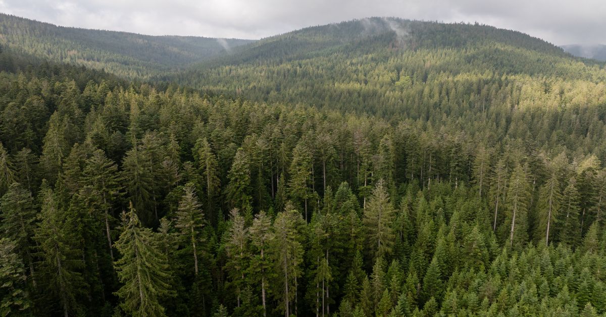
Canada’s forests cover an astonishing expanse roughly 3.5 million square kilometers, about 9% of the world’s total forest area. To put that in perspective, imagine an area larger than all of India blanketed in trees. Much of this forest lies in remote regions, far from roads or towns. There are vast stretches in the northern boreal and mountain ranges where weeks could pass without a human soul setting foot. In fact, conservation maps show Canada holds millions of hectares of intact forest landscapes mostly “in remote areas far from human activity”. These are wild places that have remained essentially untouched. They’re mapped from satellites, yes, but “mapped” is not the same as truly known. On the ground, what’s happening out there often remains a mystery.
It’s a bit unsettling even in a developed country like Canada, we still don’t really know what’s going on deep in our own backwoods. For all the satellite images and occasional fly overs, a lot can hide beneath that endless green canopy. Animals could be migrating or dying off without anyone noticing, and small wildfires or insect outbreaks might be smoldering for days before they’re spotted. There’s a sense that beyond the edges of our roads and trails, an enormous living world is carrying on out of sight. Why don’t we know more? Well, simply getting eyes on these remote forests is incredibly tough. It’s one of the biggest challenges scientists and conservation officials face in Canada.
The Challenge of Keeping Watch in Remote Woods
Monitoring such remote forests is easier said than done. The first big hurdle is distance and accessibility. You can’t just drive into most of these areas there are no roads for hundreds of kilometers. (Canada actually has over 1.5 million km of logging and resource roads, but even those snake mostly through southern forests, and beyond them lies even more wilderness.) For a researcher or ranger to physically check on a remote forest valley, it might require days of hiking or an expensive helicopter ride. That’s simply not practical on a large scale. In the Northwest Territories, for example, there are around 40 million hectares of forest spread sparsely across the territory. Local experts have admitted it’s “impractical to undertake a conventional forest inventory” over such a vast area. In other words, they just can’t send enough people out there to survey it all.
Because getting boots on the ground is so difficult, Canada relies heavily on technology to watch its forests. Airplanes and satellites have become our eyes in the sky. We use satellite images to detect big changes like large clear-cuts, massive wildfires, or broad insect damage. These tools are invaluable, but they have limits. Satellite forest inventories are basically the only feasible way to map the most remote regions, yet satellites might pass overhead only once every few days at high resolution. They can miss the early signs of trouble. And while they see the “big picture” well (like the outline of a burnt area), they can’t always tell what’s happening underneath the canopy or how wildlife is faring. Small-scale changes say a subtle decline in one animal species, or a disease slowly killing certain trees might not be obvious from space.
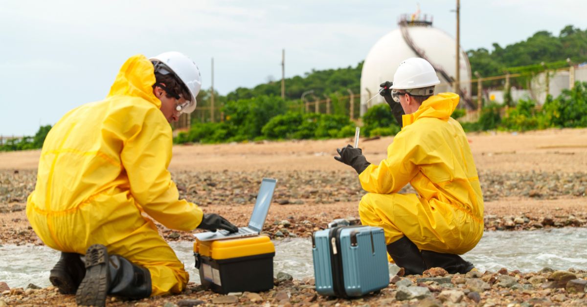
Traditional methods of wildlife monitoring don’t fare much better out here. Aerial surveys by plane or helicopter have long been used to count animals like caribou or moose over large areas, but doing this in truly remote regions is hugely expensive and logistically hard. Helicopter wildlife surveys in Canada can cost $3,000 to $10,000 per day, and even then they only sample portions of habitat. Ground surveys by biologists, where people trek and collect data, are even more limited a single big field effort can cost over $5,000 for just a section of forest. No surprise that such surveys are infrequent and cover tiny fractions of the land. There just isn’t enough time, money, or people to continuously patrol millions of hectares of wilderness in person.
The result? Huge knowledge gaps. We end up piecing together an understanding of remote forests with partial data and a lot of inference. It’s a bit like trying to watch a vast football stadium through a keyhole you catch a glimpse here and there, but you know you’re missing a lot of the action. Officials might have to make big decisions with only rough estimates of wildlife populations or sketchy information on habitat conditions in the far-off bush. This can feel frustrating. Even in 2025, with all our gadgets, we’re often essentially guessing at what’s going on out there.
What We Might Be Missing Out There
The lack of on-the-ground eyes in remote forests means many changes go unnoticed until they reach a tipping point. A clear example is wildfires. In populated areas, if a fire starts, someone will see smoke and report it. But in the deep wilderness, a lightning-sparked fire can smolder and spread with “not a lot of eyes on it … it can delay detection”. Fire crews often only learn about a remote blaze once it gets large enough for satellites to pick up or when winds carry the smoke to communities far away. By then, it might have grown into a raging inferno. Canada’s horrific 2023 fire season underscored this: many fires started in far northern forests where no one was around to notice at first. If detection is delayed by even an hour or two, a fire can explode in size under dry conditions. Unfortunately, some remote fires likely burned for days before we knew, simply because we had no boots on the ground nearby. This “out of sight, out of mind” aspect makes fighting wildfires in remote areas reactive instead of proactive.
It’s not just fires. Insect outbreaks and diseases can silently wreak havoc in these forests. Take the mountain pine beetle, a tiny insect that ended up killing an enormous swath of British Columbia’s forests. Locals eventually saw whole mountainsides of pine turning red and dying a striking sign of infestation. But by the time it was fully recognized, the outbreak was unstoppable. In the early 1990s, the beetle was chewing through about 45,000 hectares of forest per year; by the 2000s, it was suddenly devouring over 6.4 million hectares per year at its peak. That kind of exponential spread in remote areas is hard to catch early. No one is out there counting beetle holes in trees until the damage is massive. Similarly, government reports show that in 2022, roughly 13 million hectares of Canadian forest were hit by severe insect defoliation a huge area. How many of those infestations were noticed on the ground while they were starting? Probably very few. In many cases we only realize the scale of an outbreak after satellites show entire regions of dead trees, or when timber companies stumble on it.
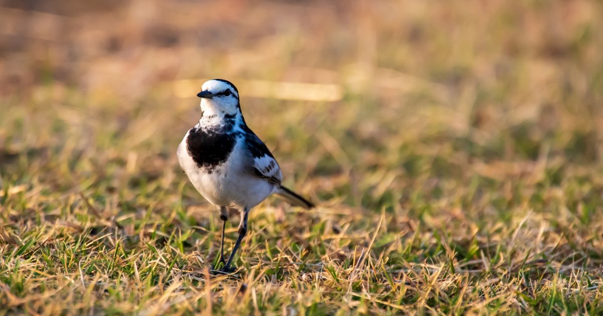
Wildlife trends are another big blind spot. Canada prides itself on its wildlife, from woodland caribou to grizzlies, but in remote forests we often don’t have solid numbers for how those animals are doing. Woodland caribou, for instance, roam vast northern ranges. Biologists might collar a handful and use aerial surveys here and there, but it’s tricky to monitor such an elusive species over thousands of square kilometers. If a remote caribou herd is declining, we might not notice until it’s critically low. Indeed, the number of species at risk in Canada has been creeping up year after year. An independent national panel found that over the past 25 years, new species have been added to the at-risk list at an average rate of about 4% more each year. In other words, despite conservation efforts, more species keep slipping into trouble. Part of the reason is that we don’t detect problems early enough, especially in far-off habitats. By the time a species is visibly crashing, it’s already at risk. Officials have acknowledged that without “innovative, non-invasive monitoring solutions implemented promptly, Canada risks losing iconic species”. It’s a sobering thought: there could be declines happening right now, deep in the woods, and we won’t know until it’s nearly irreversible.
There’s also the human factor illegal or unregulated activities that could be happening out of sight. While Canada’s forest management is generally strict, the sheer remoteness provides cover for things like unauthorized logging or poaching. With over a million kilometers of resource roads cut into forests, people can access many wild areas. But beyond where roads end, or even along seldom-patrolled roads, who’s watching? Occasionally, enforcement officers find evidence of illegal hunting camps or surprise clearings. These incidents hint at what might slip under the radar. If no one is regularly present, a lot can happen quietly. For instance, small-scale logging operations could clear pockets of old-growth in the far north without immediate detection the satellite might just register it months later as a minor change. The same goes for pollution or dumping; in an unmonitored expanse, problems can stay hidden for years.
In short, the remote forests are full of unknowns. Important changes whether natural or human-caused often unfold without us knowing in real time. This knowledge gap isn’t just academic; it has real consequences. It means management decisions are made with uncertainty, and sometimes we only react to environmental crises after they’ve blown up. Canadians are increasingly realizing that we need to shine a light into these green shadows if we want to protect our natural heritage.
New Eyes in the Forest: How Technology (and People) Are Stepping Up
The good news is that Canada isn’t just throwing up its hands. A lot of brainpower and new tech is being thrown at this very problem: how to know what’s happening in remote forests without physically being there all the time. One big piece of the puzzle is better remote sensing from above. We already lean on satellites like NASA’s Landsat and the EU’s Sentinel for forest monitoring; now even more advanced eyes are joining the fray. For example, LiDAR sensors on satellites (like NASA’s GEDI mission) can actually measure forest structure and tree height from space, helping us estimate biomass and detect subtle changes in canopy condition. Scientists describe this as part of a “big data revolution” in forest remote sensing. By crunching large satellite datasets, they can observe forest changes, map what types of trees are where, and even predict things like wildfire risk in some areas. Essentially, our space-based snapshots are getting more detailed and more frequent. While a satellite will never see a poacher in action or count every bird, it can raise alarms: “Hey, something’s changed in this 50-hectare patch of forest that was intact last month.” Having those alerts gives rangers a clue about where to focus.
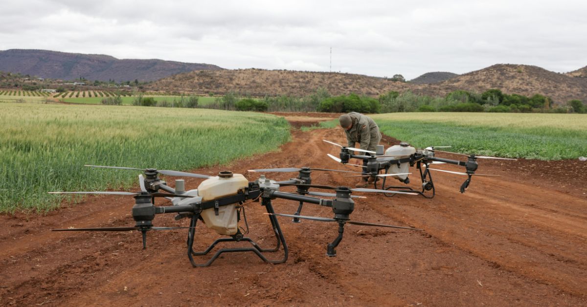
Another promising approach is to bring the sensors closer via drones and ground devices. Drones in particular are game-changing for accessing remote areas. Unlike a helicopter, a drone doesn’t need a landing pad or a pilot on board, and it’s far cheaper to deploy. We’re seeing Canadian researchers and startups use drones equipped with high-definition cameras, thermal imaging, and even acoustic sensors to scout wilderness from above. For example, an initiative in B.C. has been using small AI-powered sensors strapped to trees and drones to detect wildfires in their first minutes. These devices can sniff out the faint traces of smoke or heat and alert fire crews “within minutes instead of an hour or more”. That’s a huge improvement for early wildfire response in remote forests.
Drones are also being used to quietly survey wildlife and habitat in ways that were impossible before. A drone can fly low over a forest canopy or skim above a wetland at dawn, recording animal movements that human observers would likely miss. Importantly, they can cover ground without disturbing wildlife (no noisy chopper blades thumping overhead). Some Canadian teams are even deploying multi-environment drones rugged drones that can handle aerial, aquatic, and ground terrain to reach into every nook of the wild. These advanced platforms carry modular sensors and use AI-driven analytics to identify animals or changes in vegetation in real time. It’s not sci-fi; it’s happening. Aerowild Tech, as one example, is a Canadian startup focusing on this approach. Their drones are designed to operate in harsh conditions (from dense forests to northern swamps) and stream back data live. The AI can flag things like a herd of deer moving, or an unusual thermal hotspot under the canopy. Early trials suggest that drone-based wildlife surveys can be remarkably effective delivering population counts up to 43% to 96% more accurate than traditional manual counts. And because one operator can send a drone over a large area, monitoring efficiency shoots up (some reports say by up to 80% higher habitat coverage in the same time). On top of that, using drones could cut costs dramatically 30–50% cheaper than chartering aircraft for surveys. All of this means we could afford to watch more territory, more frequently, and with finer detail.
Beyond high-tech gadgets, there’s also a human element: involving the people who are on the land. Indigenous communities and local observers are crucial allies in knowing what’s happening in remote forests. Many First Nations in Canada have Guardian programs trained community members who monitor their traditional territories. They track wildlife, environmental changes, and even human impacts like unauthorized logging. These Guardians often cover remote areas that no government scientist visits. They can report back in real time via satellite phones or community networks. Supporting and expanding such programs effectively puts more knowledgeable eyes on the ground in places outsiders rarely go. It’s not high-tech, but it’s highly effective local tech, so to speak. In recent years, collaborations between scientists and Indigenous observers have helped fill data gaps on things like caribou calf births or water quality in isolated lakes.
Finally, all these streams of data from satellites, drones, sensors, and ground observers are starting to come together. Big data platforms (some open-source, some government-run) can ingest satellite imagery, drone photos, and field notes to paint a more complete picture. For instance, the Global Forest Watch platform integrates satellite alerts with local reports to highlight deforestation or fires in near-real time. Having up-to-date maps and data is empowering. One analysis of intact forests noted that accurate maps “arm policy-makers and forest managers with the information they need” to take action and protect these ecosystems. In the same vein, Canadian agencies are developing dashboards where a wildlife manager might see everything from weekly fire detections to the latest drone wildlife count in one interface. It’s not perfect yet, but we’re headed for a future where no part of the forest will have to remain completely in the dark.
Bridging the Knowledge Gap
Canada’s remote forests will likely always hold some mysteries – that’s part of their allure. But the situation is already improving as better monitoring tools and strategies take root. We’re learning to work smarter, not just harder, when it comes to keeping an eye on the backcountry. Instead of sporadic, expensive expeditions, we now have continuous monitoring from above and increasingly from within the forests themselves. When a problem sparks in the wilderness be it a fire, an invasive pest, or an animal population crash there’s a better chance we’ll catch wind of it early than we would have a decade ago. The gap between what’s happening out there and what we know about it is starting to narrow.
That said, it’s a big gap to close. Canada’s wilderness is truly immense, and there will always be more demand for information than there are resources to gather it. But each year, the picture gets a bit clearer. Investments in drone networks, AI analysis, community monitoring, and satellite tech are all pieces of the solution. It’s a kind of modern exploration not about discovering new lands, but about finally understanding the ones we have. The hope is that by illuminating the remote corners, Canada can better protect them. You can’t manage what you don’t measure, as the saying goes. Well, we’re learning to measure even the most remote forest now, in clever ways that previous generations of conservationists only dreamed of.
In the end, ensuring we do know what’s happening in our remote forests isn’t just for curiosity’s sake. It means being able to react quickly to natural disasters, to save species before they’re on the brink, and to hold accountable those who use the forest responsibly or otherwise. It’s about stewardship of an enormous national treasure. There’s something inspiring about that the idea that even the quietest, loneliest grove of trees up north has someone looking out for it, whether that’s a satellite overhead or a drone buzzing through the spruce. Canada is taking steps so that “remote” doesn’t have to mean “forgotten.” With patience and innovation, we’re getting closer to the day when no forest, however distant, is truly unknowable.